IMAGES TAKEN NEAR TO
Charles Road, FELIXSTOWE, IP11 2PH
Introduction
This page details the photographs taken nearby to Charles Road, IP11 2PH by members of the Geograph project.
The Geograph project started in 2005 with the aim of publishing, organising and preserving representative images for every square kilometre of Great Britain, Ireland and the Isle of Man.

There are currently over 7.5m images from over14,400 individuals and you can help contribute to the project by visiting https://www.geograph.org.uk
Image Map
Images are licensed for reuse under creativecommons.org/licenses/by-sa/2.0
Notes
- Clicking on the map will re-center to the selected point.
- The higher the marker number, the further away the image location is from the centre of the postcode.
Image Listing (7 Images Found)
Images are licensed for reuse under creativecommons.org/licenses/by-sa/2.0
Image
Details
Distance
1
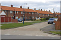
Butley Road, Felixstowe
Butley Road leads off Coronation Drive and has terraced local authority built houses probably dating from the 1950s.
Image: © Stephen McKay
Taken: 26 Mar 2018
0.09 miles
2
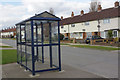
Coronation Drive, Felixstowe
Close to Kings Fleet Drive and Anne Street, the shelter can be used by passengers waiting for buses to the town centre and on to Ipswich.
Image: © Stephen McKay
Taken: 26 Mar 2018
0.13 miles
3
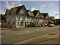
Picturesque building
Old building, apparently divided into apartments, in Langer Road.
Image: © Carl Grove
Taken: 9 Aug 2015
0.20 miles
4
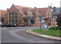
Bethesda Baptist Church, Felixstowe
Looking across the roundabout on the A154.
Image: © Andrew Hill
Taken: 7 Oct 2008
0.20 miles
5
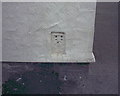
OS Flush Bracket 2071 Felixstowe
Felixstowe, Tidal Gauge Aux 1.
www.bench-marks.org.uk/bm779
Image: © Richard Neale
Taken: 1 Nov 2001
0.21 miles
6
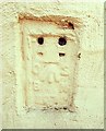
Flush Bracket OSBM 2071 Felixstowe Langer Road Tide Gauge Aux 1
Flush Bracket OSBM 2071 Felixstowe Langer Road Tide Gauge Aux 1 NW face, W angle.
Image: © Cud05
Taken: 11 Apr 2016
0.21 miles