IMAGES TAKEN NEAR TO
Vicarage Road, FELIXSTOWE, IP11 2LR
Introduction
This page details the photographs taken nearby to Vicarage Road, IP11 2LR by members of the Geograph project.
The Geograph project started in 2005 with the aim of publishing, organising and preserving representative images for every square kilometre of Great Britain, Ireland and the Isle of Man.

There are currently over 7.5m images from over14,400 individuals and you can help contribute to the project by visiting https://www.geograph.org.uk
Image Map
Images are licensed for reuse under creativecommons.org/licenses/by-sa/2.0
Notes
- Clicking on the map will re-center to the selected point.
- The higher the marker number, the further away the image location is from the centre of the postcode.
Image Listing (5 Images Found)
Images are licensed for reuse under creativecommons.org/licenses/by-sa/2.0
Image
Details
Distance
2
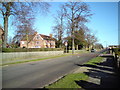
Grange Road, Felixstowe
Looking north along Grange Road with The Vicarage, near Grange C.P. School to the left of the shot.
Image: © Tim Marchant
Taken: 8 Feb 2011
0.10 miles
3
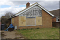
Derelict bungalow - Grange Road, Felixstowe
Sometimes even reasonably modern houses in pleasant areas end up like this. There can be a variety of reasons and the specific story here is not known. Zoopla suggests that it should be worth around £250,000 - but presumably considerably less in this state. It is one of a row of four similar bungalows - all the others are obviously well looked after. Google Streetview from 2011 shows it apparently still occupied but already in a dilapidated condition. Curiously, the blue tarpaulin on the drive was there then.
Image: © Stephen McKay
Taken: 26 Mar 2018
0.13 miles