1
Felixstowe Beach caravan park
Main entrance of the largest caravan park in the town.
Image: © Carl Grove
Taken: 8 Aug 2015
0.17 miles
2
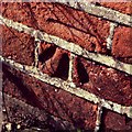
Cut Mark Felixstowe St Edmunds District Church
Cut Mark Felixstowe St Edmunds District Church SE face.
Image: © Cud05
Taken: 9 Mar 2019
0.18 miles
3
Flush Bracket OSBM 2071 Felixstowe Langer Road Tide Gauge Aux 1
Flush Bracket OSBM 2071 Felixstowe Langer Road Tide Gauge Aux 1 NW face, W angle.
Image: © Cud05
Taken: 11 Apr 2016
0.18 miles
4
OS Flush Bracket 2071 Felixstowe
Felixstowe, Tidal Gauge Aux 1.
www.bench-marks.org.uk/bm779
Image: © Richard Neale
Taken: 1 Nov 2001
0.18 miles
5
Picturesque building
Old building, apparently divided into apartments, in Langer Road.
Image: © Carl Grove
Taken: 9 Aug 2015
0.18 miles
6
Butley Road, Felixstowe
Butley Road leads off Coronation Drive and has terraced local authority built houses probably dating from the 1950s.
Image: © Stephen McKay
Taken: 26 Mar 2018
0.22 miles
7
Railway towards Ipswich
Site of the former Felixstowe Beach Railway Station. Station closed in 1967.
Image: © JThomas
Taken: 13 May 2023
0.22 miles
8
Coronation Drive, Felixstowe
Close to Kings Fleet Drive and Anne Street, the shelter can be used by passengers waiting for buses to the town centre and on to Ipswich.
Image: © Stephen McKay
Taken: 26 Mar 2018
0.22 miles
9
Closed station, Felixstowe Beach 1988
View southward, towards Felixstowe South Terminal, formerly to Felixstowe Pier station: ex-GER branch from Ipswich. The Pier station was closed 2/7/51, this station 11/9/67 (Summer only to 11/59) and was demolished in 2004, but the line to the Container Terminal remains.
Image: © Ben Brooksbank
Taken: 29 Apr 1988
0.23 miles
10
Felixstowe Beach railway station (site), Suffolk
Opened as "Felixstowe Town" in 1877 by the Felixstowe Railway and Pier Company, later part of the Great Eastern Railway, on the line from Ipswich to Felixstowe Pier. The name was changed to "Felixstowe Beach" in 1898 when the current Felixstowe station was opened. This station closed in 1967 and the wooden buildings were demolished in 2004.
View north towards the current Felixstowe station; also Ipswich. The line is still heavily used by freight traffic to the docks.
Image: © Nigel Thompson
Taken: 9 Apr 2022
0.23 miles


