1
Car Park and new buildings
The new development will surround the Martello Tower.
Image: © Adrian S Pye
Taken: 17 Sep 2014
0.02 miles
2
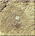
Rivet Felixstowe 153 Langer Road
Rivet, Felixstowe, 153 Langer Road (A154 South) pavement adjacent to Indo European Foods Factory Entrance.
Image: © Cud05
Taken: 11 Feb 2016
0.04 miles
3
Orford Road, Felixstowe
The southernmost of the series of residential streets running back from the shore in this part of town.
Image: © Andrew Hill
Taken: 14 Aug 2009
0.05 miles
4
Houses in Orford Road, Felixstowe
The white-flowering plants seen in the foreground are sea kale (Crambe maritima),
commonly found above the high tide mark on shingle beaches. By the early 18th century it had become established as a garden vegetable, but its height of popularity was the early 19th century, when it was featured in Thomas Jefferson's Garden Book (published in 1809). The shoots are served like asparagus.
Image: © Evelyn Simak
Taken: 25 May 2012
0.06 miles
5
Sea kale growing along the Esplanade, Felixstowe
Houses in Orford Road can be seen in the background. The white-flowering plants seen in the foreground are sea kale (Crambe maritima),commonly found above the high tide mark on shingle beaches. By the early 18th century it had become established as a garden vegetable, but its height of popularity was the early 19th century, when it was featured in Thomas Jefferson's Garden Book (published in 1809). The shoots are served like asparagus.
Image: © Evelyn Simak
Taken: 25 May 2012
0.06 miles
6
Commemorative stone on the Esplanade, Felixstowe
It commemorates the completion of the Felixstowe Flood Alleviation Scheme, and is dated 1 October 2008 > http://www.geograph.org.uk/photo/2961671.
Image: © Evelyn Simak
Taken: 25 May 2012
0.06 miles
7
Commemorative stone on the Esplanade, Felixstowe - plaque
For a wider view of this location see > http://www.geograph.org.uk/photo/2961669.
Image: © Evelyn Simak
Taken: 25 May 2012
0.06 miles
8
Over the fence
The rear gardens of houses in Langer Road, Felixstowe.
Image: © Bob Jones
Taken: 26 Sep 2008
0.07 miles
9
Carr Road, Felixstowe
Image: © Adrian S Pye
Taken: 17 Sep 2014
0.08 miles
10
Commemorative stone on Felixstowe beach
This stone commemorates the completion of the Felixstowe Flood Alleviation Scheme, and is dated 1 October 2008.
Image: © Oxymoron
Taken: 28 Dec 2008
0.08 miles


