IMAGES TAKEN NEAR TO
High Road, FELIXSTOWE, IP11 0SZ
Introduction
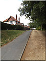
This page details the photographs taken nearby to High Road, IP11 0SZ by members of the Geograph project.
The Geograph project started in 2005 with the aim of publishing, organising and preserving representative images for every square kilometre of Great Britain, Ireland and the Isle of Man.

There are currently over 7.5m images from over14,400 individuals and you can help contribute to the project by visiting https://www.geograph.org.uk
Image Map
Images are licensed for reuse under creativecommons.org/licenses/by-sa/2.0
Notes
- Clicking on the map will re-center to the selected point.
- The higher the marker number, the further away the image location is from the centre of the postcode.
Image Listing (60 Images Found)
Images are licensed for reuse under creativecommons.org/licenses/by-sa/2.0
Image
Details
Distance
1
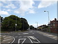
High Road, Trimley St. Mary
At the junction with Faulkeners Way
Image: © Geographer
Taken: 12 Jul 2015
0.01 miles
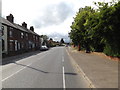
2
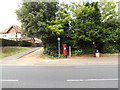
Kingsbury Road, Trimley St. Mary
At the junction with High Road
Image: © Geographer
Taken: 12 Jul 2015
0.05 miles
3
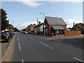
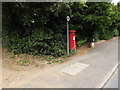
High Road, Trimley St Mary
At the junction with Kingsbury Road
Image: © Geographer
Taken: 12 Jul 2015
0.05 miles
4
High Road, Trimley St Mary
At the junction with Kingsbury Road
Image: © Geographer
Taken: 12 Jul 2015
0.06 miles
5
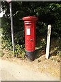
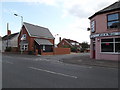
Almshouses George V Postbox
On High Road at the junction with Kingsbury Road
Postbox No.IP11 1131
Image: © Geographer
Taken: 12 Jul 2015
0.08 miles
6
Almshouses George V Postbox
On High Road at the junction with Kingsbury Road
Postbox No.IP11 1131
Image: © Geographer
Taken: 12 Jul 2015
0.08 miles
7
Almshouses George V Postbox
On High Road at the junction with Kingsbury Road
Postbox No.IP11 1131
Image: © Geographer
Taken: 12 Jul 2015
0.08 miles
8
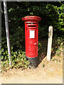
Almshouses George V Postbox
On High Road at the junction with Kingsbury Road
Postbox No.IP11 1131
(Close up)
Image: © Geographer
Taken: 12 Jul 2015
0.08 miles
10
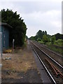
Eastern end of Trimley Station
This image shows the disused sections of platform at the eastern end of Trimley station. The platform on the right is disused in its entirety, with the line passing it giving access to the western end of the Port of Felixstowe freight loop and can be seen curving sharply to the right just beyond the end of the platform. The left hand platform is still in use, but only for part of its length, and is served by the hourly passenger services between Ipswich and Felixstowe, and vice versa. The line passing this platform is also used by container trains to and from the eastern end of the freight loop.
Image: © Glen Denny
Taken: 12 Jun 2010
0.16 miles