IMAGES TAKEN NEAR TO
Thurmans Lane, FELIXSTOWE, IP11 0SR

Introduction

This page details the photographs taken nearby to Thurmans Lane, IP11 0SR by members of the Geograph project.

The Geograph project started in 2005 with the aim of publishing, organising and preserving representative images for every square kilometre of Great Britain, Ireland and the Isle of Man.

There are currently over 7.5m images from over14,400 individuals and you can help contribute to the project by visiting https://www.geograph.org.uk

Image Map


Images are licensed for reuse under creativecommons.org/licenses/by-sa/2.0
Notes
  • Clicking on the map will re-center to the selected point.
  • The higher the marker number, the further away the image location is from the centre of the postcode.

Image Listing (48 Images Found)

Images are licensed for reuse under creativecommons.org/licenses/by-sa/2.0
  • ...
Image
Details
Distance
1
Across Thurmans lane to field of Rapeseed
Looking from Trimley St Mary towards Trimley St Martin
Image: © Paul Greenwood Taken: 4 May 2003
0.09 miles
2
Seven Oaks
Fine house behind Trimley's twin churches, now a hostel.
Image: © Tim Marchant Taken: 7 Aug 2009
0.11 miles
3
The Old Rectory, Church Lane
Image: © Oxymoron Taken: 18 Feb 2009
0.11 miles
4
Church Lane
Image: © Oxymoron Taken: 29 May 2009
0.14 miles
5
St. Mary's; the parish church of Trimley St. Mary
This church shares its churchyard with the parish church of Trimley St. Martin and has not been in use as a church since the 1980s. It is now used as a multi-purpose community building. Although much of what is seen today is the result of heavy Victorian restoration, the church dates back to the 14th century.
Image: © Robert Edwards Taken: 19 Sep 2007
0.15 miles
6
Trimley St Mary church
Image: © Oxymoron Taken: 16 Mar 2009
0.15 miles
7
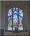
Trimley St. Mary's World War Two Memorial window
The window bears the names of six men lost in WW2. The image was taken through the only clear glass window but I was unable to see the WW1 Memorial. The building is redundant as a church and is utilised as a community centre and children's playroom. I can confirm that the WW1 Memorial has 17 names.
Image: © Adrian S Pye Taken: 19 Aug 2015
0.15 miles
8
St. Mary's
St. Mary's, Trimley St. Martin, Ipswich Suffolk. http://www.suffolkchurches.co.uk/trimleymartin.html http://www.geograph.org.uk/photo/283413
Image: © Keith Evans Taken: 23 Nov 2006
0.16 miles
9
St. Mary's Church and churchyard, Trimley
Looking across the churchyard towards the Victorian rectory. The church is now used as an arts centre.
Image: © Simon Mortimer Taken: 22 Aug 2020
0.16 miles
10
Trimley St Mary?s church
The tower is 14th century but is a pitiful sight. The church is rendered in cement and not at all appealing to the visitor. The corbels of the windows depict the heads of a monk, nun, bishop and king. You are greeted by a grinning face over the door and inside on the tower arch there are more carvings, this time of angels. The sanctuary is panelled and has a richly decorated reredos against the east wall. The church is still consecrated but is used by a mother and toddler group and it is no more than a children’s playroom. The only thing of real interest is standing beside the path; it is a 12th century square font with a round bowl. I was told it was brought to this spot centuries ago, when the church of Alston St John the Baptist in Lower Trimley was demolished in around 1500.
Image: © Adrian S Pye Taken: 8 Feb 2008
0.16 miles
  • ...