IMAGES TAKEN NEAR TO
Durilda Green, IPSWICH, IP10 0NQ
Introduction
This page details the photographs taken nearby to Durilda Green, IP10 0NQ by members of the Geograph project.
The Geograph project started in 2005 with the aim of publishing, organising and preserving representative images for every square kilometre of Great Britain, Ireland and the Isle of Man.

There are currently over 7.5m images from over14,400 individuals and you can help contribute to the project by visiting https://www.geograph.org.uk
Image Map
Images are licensed for reuse under creativecommons.org/licenses/by-sa/2.0
Notes
- Clicking on the map will re-center to the selected point.
- The higher the marker number, the further away the image location is from the centre of the postcode.
Image Listing (65 Images Found)
Images are licensed for reuse under creativecommons.org/licenses/by-sa/2.0
Image
Details
Distance
1
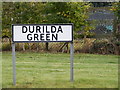
Durilda Green sign
At the junction with Trimley Road
Image: © Geographer
Taken: 10 Oct 2011
0.03 miles
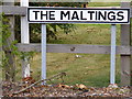
2
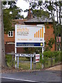
New Development Board & The Maltings Sign
Off Trimley Road
Image: © Geographer
Taken: 13 Oct 2011
0.03 miles
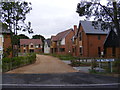
3
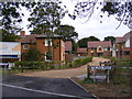
The entrance to The Maltings
Off Trimley Road
Image: © Geographer
Taken: 13 Oct 2011
0.03 miles
6
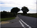
Trimley Road, Kirton
At the junction with Durilda Green looking toward the Back Road / Innocence Lane junction.
Image: © Geographer
Taken: 10 Oct 2011
0.03 miles
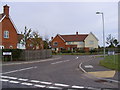
7
Trimley Road, Kirton
At the junction with Druilda Green
Image: © Geographer
Taken: 10 Oct 2011
0.03 miles
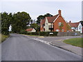
8
Durilda Green, Kirton
At the junction with Trimley Road
Image: © Geographer
Taken: 10 Oct 2011
0.03 miles
9
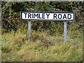
Trimley Road sign
At the junction with Druilda Green
Image: © Geographer
Taken: 10 Oct 2011
0.04 miles