IMAGES TAKEN NEAR TO
Bridge Road, IPSWICH, IP10 0LZ
Introduction
This page details the photographs taken nearby to Bridge Road, IP10 0LZ by members of the Geograph project.
The Geograph project started in 2005 with the aim of publishing, organising and preserving representative images for every square kilometre of Great Britain, Ireland and the Isle of Man.

There are currently over 7.5m images from over14,400 individuals and you can help contribute to the project by visiting https://www.geograph.org.uk
Image Map
Images are licensed for reuse under creativecommons.org/licenses/by-sa/2.0
Notes
- Clicking on the map will re-center to the selected point.
- The higher the marker number, the further away the image location is from the centre of the postcode.
Image Listing (39 Images Found)
Images are licensed for reuse under creativecommons.org/licenses/by-sa/2.0
Image
Details
Distance

2
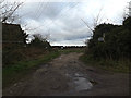
Bridleway to Levington Road
Off Bridge Road
Image: © Geographer
Taken: 9 Jan 2014
0.13 miles
3
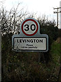
Levington Village Name sign
On Bridge Road entering Levington Village near White House Farm
Image: © Geographer
Taken: 9 Jan 2014
0.17 miles
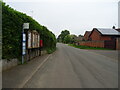
4
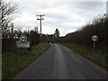
Entering Levington Village on Bridge Road
Near White House Farm
Image: © Geographer
Taken: 9 Jan 2014
0.17 miles
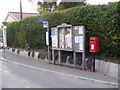
5
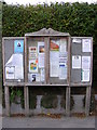
Levington Village Notice Board
Bridge Road
Image: © Geographer
Taken: 10 Oct 2011
0.18 miles
6
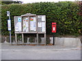
Bus Stop, Village Notice Board & Village Hall Postbox
Postbox No.IP10 1232
Image: © Geographer
Taken: 10 Oct 2011
0.18 miles
7
Bus Stop, Village Notice Board & Village Hall Postbox
Postbox No.IP10 1232
Image: © Geographer
Taken: 10 Oct 2011
0.18 miles
9
Bridge Road, Levington
Showing position of Postbox No. IP10 1232.
See Image] for postbox.
Image: © JThomas
Taken: 13 May 2023
0.19 miles
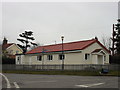
10
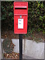
Village Hall Postbox
Postbox No.IP10 1232
Image: © Geographer
Taken: 10 Oct 2011
0.19 miles