IMAGES TAKEN NEAR TO
Brook Way, CHIGWELL, IG7 6AW
Introduction
This page details the photographs taken nearby to Brook Way, IG7 6AW by members of the Geograph project.
The Geograph project started in 2005 with the aim of publishing, organising and preserving representative images for every square kilometre of Great Britain, Ireland and the Isle of Man.

There are currently over 7.5m images from over14,400 individuals and you can help contribute to the project by visiting https://www.geograph.org.uk
Image Map
Images are licensed for reuse under creativecommons.org/licenses/by-sa/2.0
Notes
- Clicking on the map will re-center to the selected point.
- The higher the marker number, the further away the image location is from the centre of the postcode.
Image Listing (49 Images Found)
Images are licensed for reuse under creativecommons.org/licenses/by-sa/2.0
Image
Details
Distance
1
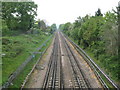
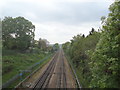
Chigwell: Central Line
This is the rural view of the line looking west from the A113 High Road bridge towards the M11 Motorway crossing and Image
The track was built in 1903 by the Great Eastern Railway when they opened their Woodford and Ilford Branch through here. On the grouping of the railway companies in 1923 operational responsibilites passed to the London & North Eastern Railway, and in due course in 1948 to the Central Line of the London Underground.
Image: © Nigel Cox
Taken: 29 Apr 2011
0.13 miles
2
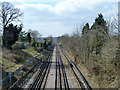
Central Line west of Chigwell station
Opened in 1903 as the Great Eastern Railway's Fairlop Loop, Central Line tube trains took over in 1948.
Image: © Robin Webster
Taken: 1 Apr 2013
0.13 miles
3
Small green, Chigwell
In the angle of Chigwell Rise and Lee Grove.
Image: © Robin Webster
Taken: 1 Apr 2013
0.16 miles
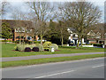
7
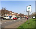
Chigwell Village Sign
Chigwell is an ancient settlement mentioned in the Domesday Book.
Image: © Des Blenkinsopp
Taken: 8 Apr 2015
0.16 miles
9
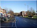
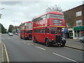
High Road, Chigwell
Looking north from just north of Chigwell station, with the shopping parade on the left and playground on the right.
Image: © John Davies
Taken: 19 Dec 2005
0.17 miles
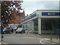
10
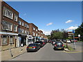
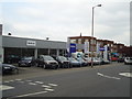
Shopping parade, Chigwell
A parade of shops in Chigwell, in Essex. The village sign is visible to the right of the image, on the opposite side of the road. The road forms part of the A113.
Image: © Malc McDonald
Taken: 17 Aug 2019
0.17 miles