IMAGES TAKEN NEAR TO
St. Marys Way, CHIGWELL, IG7 5BX
Introduction
This page details the photographs taken nearby to St. Marys Way, IG7 5BX by members of the Geograph project.
The Geograph project started in 2005 with the aim of publishing, organising and preserving representative images for every square kilometre of Great Britain, Ireland and the Isle of Man.

There are currently over 7.5m images from over14,400 individuals and you can help contribute to the project by visiting https://www.geograph.org.uk
Image Map
Images are licensed for reuse under creativecommons.org/licenses/by-sa/2.0
Notes
- Clicking on the map will re-center to the selected point.
- The higher the marker number, the further away the image location is from the centre of the postcode.
Image Listing (14 Images Found)
Images are licensed for reuse under creativecommons.org/licenses/by-sa/2.0
Image
Details
Distance
2
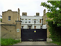
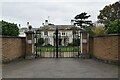
The former Great West Hatch Hospital
Until 1992 a small mental hospital, now part of a very up-market gated residential development, with the main entrance on the A113 main road.
Image: © Robin Webster
Taken: 2 Jun 2012
0.14 miles
4
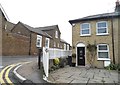
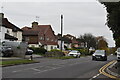
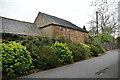
Love Lane at the junction of Turpin's Lane
Image: © David Howard
Taken: 4 Nov 2017
0.16 miles
7
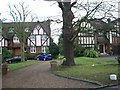
Chigwell villas
Chigwell is very much 'Footballers Wives' country with flamboyant modern mansions surrounded by security fences. Some pleasanter areas survive though, such as these houses in Forest Lane.
Image: © John Davies
Taken: 5 Jan 2006
0.18 miles
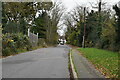
9
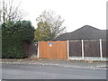
Hidden bungalow on Turpin's Lane, Woodford
For unknown reasons this was built side on to the road and invisible to the public.
Image: © David Howard
Taken: 4 Nov 2017
0.20 miles