IMAGES TAKEN NEAR TO
Church Road, LOUGHTON, IG10 4AJ
Introduction
This page details the photographs taken nearby to Church Road, IG10 4AJ by members of the Geograph project.
The Geograph project started in 2005 with the aim of publishing, organising and preserving representative images for every square kilometre of Great Britain, Ireland and the Isle of Man.

There are currently over 7.5m images from over14,400 individuals and you can help contribute to the project by visiting https://www.geograph.org.uk
Image Map
Images are licensed for reuse under creativecommons.org/licenses/by-sa/2.0
Notes
- Clicking on the map will re-center to the selected point.
- The higher the marker number, the further away the image location is from the centre of the postcode.
Image Listing (10 Images Found)
Images are licensed for reuse under creativecommons.org/licenses/by-sa/2.0
Image
Details
Distance
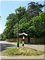
1
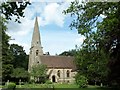
High Beach Church
High Beach Church in Epping Forest.
Image: © Alan Fleming
Taken: 25 May 2002
0.06 miles
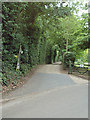
2
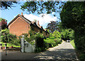
Church Road, High Beach
A minor road along the western edge of Epping Forest.
Image: © Des Blenkinsopp
Taken: 12 Jun 2014
0.07 miles
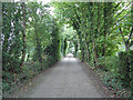
3
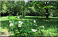
Forest beside Church Road
Church Road runs through the middle of this square and is the boundary between Epping Forest to the east and farmland on the west.
Image: © Des Blenkinsopp
Taken: 12 Jun 2014
0.08 miles
5
Wonky Signpost at High Beach
Looking more like one of those gradient markers you see beside railway tracks, this signpost looks to have been knocked about a bit.
Image: © Des Blenkinsopp
Taken: 12 Jun 2014
0.22 miles
6
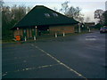
Part of the Epping Forest Field Centre, viewed from the car park
I'm unsure if this building is part of the Epping Forest Field Centre or is simply a toilet block, hence I stand to be corrected on the grid referencing. View taken from the car park.
Image: © Robert Lamb
Taken: 15 Feb 2010
0.23 miles
8
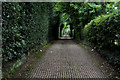
Pepper Alley (upper)
Image: © Roger Jones
Taken: 5 Jul 2011
0.23 miles
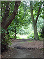
9
Pepper Alley
Bridleway leading off Mott Street in a south westerly direction through a tight green tunnel
Image: © Chris Heaton
Taken: 3 Sep 2017
0.24 miles
10
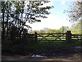
Entrances to fields on Mott Street, High Beech
Image: © David Howard
Taken: 9 Apr 2014
0.25 miles