IMAGES TAKEN NEAR TO
Colson Gardens, LOUGHTON, IG10 3RE
Introduction
This page details the photographs taken nearby to Colson Gardens, IG10 3RE by members of the Geograph project.
The Geograph project started in 2005 with the aim of publishing, organising and preserving representative images for every square kilometre of Great Britain, Ireland and the Isle of Man.

There are currently over 7.5m images from over14,400 individuals and you can help contribute to the project by visiting https://www.geograph.org.uk
Image Map
Images are licensed for reuse under creativecommons.org/licenses/by-sa/2.0
Notes
- Clicking on the map will re-center to the selected point.
- The higher the marker number, the further away the image location is from the centre of the postcode.
Image Listing (26 Images Found)
Images are licensed for reuse under creativecommons.org/licenses/by-sa/2.0
Image
Details
Distance
1
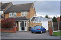
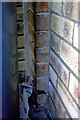
#78 Deepdene Road
There is part of an OS benchmark Image behind the wheelie bin at the junction of the house and the garage extension on the right hand face of the original house.
Image: © Roger Templeman
Taken: 21 Apr 2012
0.07 miles
2
Part benchmark on #78 Deepdene Road
The right hand half of this Ordnance Survey cut mark benchmark has been lost to a garage extension. For further information on the mark see http://www.bench-marks.org.uk/bm42722
Image: © Roger Templeman
Taken: 21 Apr 2012
0.07 miles
3
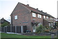
#118 Borders Lane
There is an OS benchmark Image on the side of the near house behind the black wheelie bin
Image: © Roger Templeman
Taken: 21 Apr 2012
0.13 miles
5
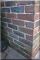
Benchmark on #118 Borders Lane
Ordnance Survey cut mark benchmark described on the Bench Mark Database at http://www.bench-marks.org.uk/bm42725
Image: © Roger Templeman
Taken: 21 Apr 2012
0.14 miles
6
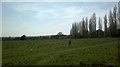
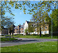
View of houses on Bryony Close from the turning circle outside Epping Forest College
Looking south-southwest.
Image: © Robert Lamb
Taken: 2 May 2013
0.15 miles
7
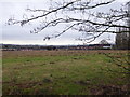
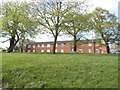
Former playing fields in Debden
Although this area of rough grassland is marked as 'playing fields' on the Ordnance Survey map it looks like some time since they were used as such. They are the private property of Epping Forest College, which is just the other side of Borders Lane, although there is free access.
The land is sufficiently high to give extensive views with the City of London and The Shard to the right and the Canary Wharf complex to the left.
Image: © Marathon
Taken: 7 Feb 2017
0.15 miles