IMAGES TAKEN NEAR TO
Oakwood Hill, LOUGHTON, IG10 3ES
Introduction
This page details the photographs taken nearby to Oakwood Hill, IG10 3ES by members of the Geograph project.
The Geograph project started in 2005 with the aim of publishing, organising and preserving representative images for every square kilometre of Great Britain, Ireland and the Isle of Man.

There are currently over 7.5m images from over14,400 individuals and you can help contribute to the project by visiting https://www.geograph.org.uk
Image Map (37 Images)


Leaflet Map data © OpenStreetMap
Images are licensed for reuse under creativecommons.org/licenses/by-sa/2.0
Notes
- Clicking on the map will re-center to the selected point.
- The higher the marker number, the further away the image location is from the centre of the postcode.
Image Listing (37 Images Found)
Images are licensed for reuse under creativecommons.org/licenses/by-sa/2.0
Image
Details
Distance
2
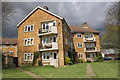
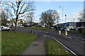
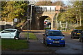
'Crossways', Oakwood Hill
There is an OS benchmark Image on the front of the building on the right hand angle
Image: © Roger Templeman
Taken: 21 Apr 2012
0.03 miles
3
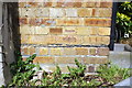
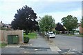
Benchmark on 'Crossways', Oakwood Hill
Ordnance Survey cut mark benchmark described on the Bench Mark Database at http://www.bench-marks.org.uk/bm42682
Image: © Roger Templeman
Taken: 21 Apr 2012
0.03 miles
8
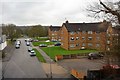
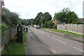
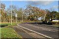
Recreation Ground, Loughton
A view from the Three Forests Way as it goes beside the River Roding.
Image: © Des Blenkinsopp
Taken: 15 Apr 2014
0.13 miles
10
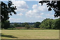
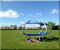
View towards Woodford from Roding Valley Nature Reserve
Looking south-southwest.
Image: © Robert Lamb
Taken: 6 Aug 2016
0.14 miles