
IMAGES TAKEN NEAR TO
Avondale Drive, LOUGHTON, IG10 3DQ
Introduction
This page details the photographs taken nearby to Avondale Drive, IG10 3DQ by members of the Geograph project.
The Geograph project started in 2005 with the aim of publishing, organising and preserving representative images for every square kilometre of Great Britain, Ireland and the Isle of Man.

There are currently over 7.5m images from over14,400 individuals and you can help contribute to the project by visiting https://www.geograph.org.uk
Image Map
Images are licensed for reuse under creativecommons.org/licenses/by-sa/2.0
Notes
- Clicking on the map will re-center to the selected point.
- The higher the marker number, the further away the image location is from the centre of the postcode.
Image Listing (19 Images Found)
Images are licensed for reuse under creativecommons.org/licenses/by-sa/2.0
Image
Details
Distance
1
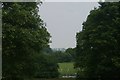
View of houses in Loughton from Roding Valley Nature Reserve #4
I have continued the numbering system from a previous shot to avoid duplication of titles. This view was taken from near the Roding Lane entrance, looking north-northwest.
Image: © Robert Lamb
Taken: 26 May 2018
0.06 miles
2
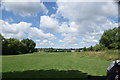
View of houses on Greensted Road from Roding Valley Nature Reserve
Looking north-northwest.
Image: © Robert Lamb
Taken: 6 Aug 2016
0.13 miles
3
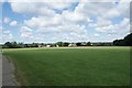
View of houses on Greensted Road from Roding Valley Nature Reserve #6
Looking south-southeast.
Image: © Robert Lamb
Taken: 6 Aug 2016
0.14 miles
4
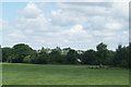
View of houses off Loughton Way from Roding Valley Nature Reserve
Looking north-northwest.
Image: © Robert Lamb
Taken: 6 Aug 2016
0.15 miles
5
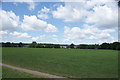
View of houses on Greensted Road from Roding Valley Nature Reserve #3
Looking north-northwest.
Image: © Robert Lamb
Taken: 6 Aug 2016
0.17 miles
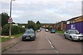
7
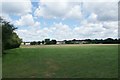
View of houses on Greensted Road from Roding Valley Nature Reserve #4
Looking west.
Image: © Robert Lamb
Taken: 6 Aug 2016
0.18 miles
8
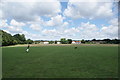
View of houses on Greensted Road from Roding Valley Nature Reserve #5
Looking north-northwest.
Image: © Robert Lamb
Taken: 6 Aug 2016
0.18 miles
9
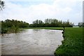
River Roding flooding
April 2012 River Roding on the brink of breaking its bank to flood the fields.
Image: © Lee Holmes
Taken: 29 Apr 2012
0.21 miles
10
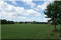
View of houses on Greensted Road from Roding Valley Nature Reserve #2
Looking west. The All Saints Church in Chigwell Row can be seen on top of the hill to the left.
Image: © Robert Lamb
Taken: 6 Aug 2016
0.22 miles