
IMAGES TAKEN NEAR TO
Chester Road, LOUGHTON, IG10 2JU
Introduction
This page details the photographs taken nearby to Chester Road, IG10 2JU by members of the Geograph project.
The Geograph project started in 2005 with the aim of publishing, organising and preserving representative images for every square kilometre of Great Britain, Ireland and the Isle of Man.

There are currently over 7.5m images from over14,400 individuals and you can help contribute to the project by visiting https://www.geograph.org.uk
Image Map
Images are licensed for reuse under creativecommons.org/licenses/by-sa/2.0
Notes
- Clicking on the map will re-center to the selected point.
- The higher the marker number, the further away the image location is from the centre of the postcode.
Image Listing (16 Images Found)
Images are licensed for reuse under creativecommons.org/licenses/by-sa/2.0
Image
Details
Distance
1
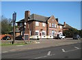
Loughton: The Gunmakers Arms
This large housing estate pub is on Chester Road. The gable end has an unusual, for this type of building, clock in it.
Image: © Nigel Cox
Taken: 8 Feb 2011
0.05 miles
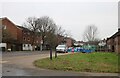
3
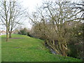
A tributary of the River Roding at Debden
Debden takes its name from the ancient manor of Debden, which lay at its northern end around Debden Green. The Debden Estate was constructed between 1947 and 1952 by the London County Council after they bought 644 acres from John Maitland.
This stream is a tributary of the River Roding. Alongside it is open parkland from Pyrles Lane to just beyond Willingale Road. Burney Drive, which is on the left here, follows the parkland almost all the way. This photograph is taken near Pyrles Lane.
Image: © Marathon
Taken: 13 Mar 2015
0.12 miles
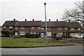
5
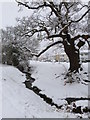
Burney Brook, Loughton
Burney Brook on a wintry morning, runs between Burney Drive and Etheridge Road
Image: © Martin Brown
Taken: 5 Feb 2012
0.18 miles
6
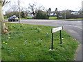
Looking across Burney Drive from Colebrooke Lane, Debden
Debden takes its name from the ancient manor of Debden, which lay at its northern end around Debden Green. The Debden Estate was constructed between 1947 and 1952 by the London County Council after they bought 644 acres from John Maitland.
The open space beyond Burney Drive features a stream which is a tributary of the River Roding. This open parkland is continuous with the stream from Pyrles Lane to just beyond Willingale Road.
Image: © Marathon
Taken: 13 Mar 2015
0.18 miles
8
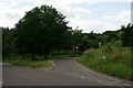
Loughton
The junction with Clays Lane, the turn for Loughton Golf Club.
Image: © Peter Trimming
Taken: 14 Jul 2016
0.21 miles

10
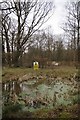
Pond in Home Mead
Home Meade is a local nature reserve consisting of 1.8 hectares of woodland and open space, in what was probably once the grounds of Debden Hall. It has been a LNR since 2004 http://www.eppingforestdc.gov.uk/index.php/out-and-about/countrycare/local-nature-reserves.
Image: © Glyn Baker
Taken: 8 Feb 2013
0.22 miles