IMAGES TAKEN NEAR TO
Colebrook Lane, LOUGHTON, IG10 2HR
Introduction
This page details the photographs taken nearby to Colebrook Lane, IG10 2HR by members of the Geograph project.
The Geograph project started in 2005 with the aim of publishing, organising and preserving representative images for every square kilometre of Great Britain, Ireland and the Isle of Man.

There are currently over 7.5m images from over14,400 individuals and you can help contribute to the project by visiting https://www.geograph.org.uk
Image Map
Images are licensed for reuse under creativecommons.org/licenses/by-sa/2.0
Notes
- Clicking on the map will re-center to the selected point.
- The higher the marker number, the further away the image location is from the centre of the postcode.
Image Listing (6 Images Found)
Images are licensed for reuse under creativecommons.org/licenses/by-sa/2.0
Image
Details
Distance
1
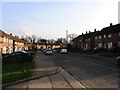
Debden streetscene
The Western part of this square has changed totally in the last 70 years. It is covered by housing and schools, but with some recreational open space. This photograph was taken in Willingdale Road, near the entrance to the playing fields. The brook, which runs from the forest down towards the Roding, is one feature which remains from the 1940s map.
Image: © Eleanor Dann
Taken: 22 Jan 2006
0.04 miles
2

Chester Road at the corner of Willingale Road
Image: © David Howard
Taken: 23 Jan 2022
0.12 miles
3

Chester Road at the corner of Willingale Road
Image: © David Howard
Taken: 23 Jan 2022
0.14 miles

5
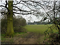
Gap between fields
Beyond are playing fields, this side a field of rough grassland prone to dampness, that seems to be a sort of informal dog walking field.
Image: © Robin Webster
Taken: 1 Apr 2013
0.23 miles
6
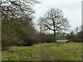
Gap between fields
Beyond are playing fields, this side a field of rough grassland prone to dampness, that seems to be a sort of informal dog walking field.
Image: © Robin Webster
Taken: 1 Apr 2013
0.23 miles