
IMAGES TAKEN NEAR TO
Prescott Green, LOUGHTON, IG10 2AQ
Introduction
This page details the photographs taken nearby to Prescott Green, IG10 2AQ by members of the Geograph project.
The Geograph project started in 2005 with the aim of publishing, organising and preserving representative images for every square kilometre of Great Britain, Ireland and the Isle of Man.

There are currently over 7.5m images from over14,400 individuals and you can help contribute to the project by visiting https://www.geograph.org.uk
Image Map
Images are licensed for reuse under creativecommons.org/licenses/by-sa/2.0
Notes
- Clicking on the map will re-center to the selected point.
- The higher the marker number, the further away the image location is from the centre of the postcode.
Image Listing (31 Images Found)
Images are licensed for reuse under creativecommons.org/licenses/by-sa/2.0
Image
Details
Distance
1

Bee on Lavender
Just prior to lift off
Image: © Martin Brown
Taken: 26 Aug 2012
0.06 miles
2

Bee on Dahlia
Having a rest and enjoying the view.
Image: © Martin Brown
Taken: 26 Aug 2012
0.06 miles
3
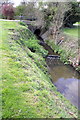
Culvert for stream under Westall Road
The stream runs parallel with Etheridge Road
Image: © Roger Templeman
Taken: 21 Apr 2012
0.07 miles
4
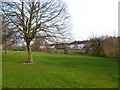
A tributary of the River Roding at Debden
Debden takes its name from the ancient manor of Debden, which lay at its northern end around Debden Green. The Debden Estate was constructed between 1947 and 1952 by the London County Council after they bought 644 acres from John Maitland.
This stream in the dip ahead is a tributary of the River Roding. Alongside it is open parkland from Pyrles Lane to just beyond Willingale Road. Burney Drive, from near where this photograph is taken, follows the parkland almost all the way. This photograph is taken near the junction of Burney Drive with Westall Road. The houses of Etheridge Road are across the other side of the parkland.
Image: © Marathon
Taken: 13 Mar 2015
0.09 miles
5
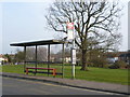
Bus stop on Burney Drive
Debden takes its name from the ancient manor of Debden, which lay at its northern end around Debden Green. The Debden Estate was constructed between 1947 and 1952 by the London County Council after they bought 644 acres from John Maitland.
The open space beyond the bus stop features a stream which is a tributary of the River Roding. This open parkland is continuous with the stream from Pyrles Lane to just beyond Willingale Road.
Image: © Marathon
Taken: 13 Mar 2015
0.12 miles
6
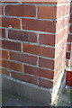
Benchmark on #18 Westall Road
Ordnance Survey cut mark benchmark described on the Bench Mark Database at http://www.bench-marks.org.uk/bm42719
Image: © Roger Templeman
Taken: 21 Apr 2012
0.12 miles

8
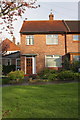
#18 Westall Road
There is an OS benchmark Image on the side of this house which is in a block of four.
Image: © Roger Templeman
Taken: 21 Apr 2012
0.13 miles
9
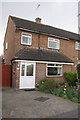
#41 Sandford Avenue
The porch extension has meant the loss of part of the OS benchmark Image on the side of the house on its original left front angle
Image: © Roger Templeman
Taken: 21 Apr 2012
0.13 miles
10
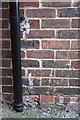
Bottom half of benchmark on #41 Sandford Avenue
Ordnance Survey cut mark benchmark (with datum line missing) described on the Bench Mark Database at http://www.bench-marks.org.uk/bm42718
Image: © Roger Templeman
Taken: 21 Apr 2012
0.13 miles