
IMAGES TAKEN NEAR TO
Wellfields, LOUGHTON, IG10 1PA
Introduction
This page details the photographs taken nearby to Wellfields, IG10 1PA by members of the Geograph project.
The Geograph project started in 2005 with the aim of publishing, organising and preserving representative images for every square kilometre of Great Britain, Ireland and the Isle of Man.

There are currently over 7.5m images from over14,400 individuals and you can help contribute to the project by visiting https://www.geograph.org.uk
Image Map
Images are licensed for reuse under creativecommons.org/licenses/by-sa/2.0
Notes
- Clicking on the map will re-center to the selected point.
- The higher the marker number, the further away the image location is from the centre of the postcode.
Image Listing (6 Images Found)
Images are licensed for reuse under creativecommons.org/licenses/by-sa/2.0
Image
Details
Distance
1
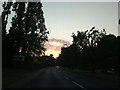
View of a dramatic sky over Rectory Lane
Looking north-northwest.
Image: © Robert Lamb
Taken: 30 Jun 2015
0.08 miles
2
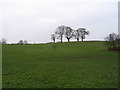
Hillyfields
This open space is at the border of Loughton and Debden, in suburbs close to Epping Forest. This area has been planted as a Millennium Remembrance Grove, including exotic trees in memory of those who died in far-flung parts of the world.
Image: © Andrew Dann
Taken: 5 Feb 2006
0.13 miles
3
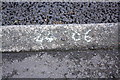
Benchmark on kerb outside #65 Newmans Lane
Ordnance Survey rivet benchmark described on the Bench Mark Database at http://www.bench-marks.org.uk/bm42681
Image: © Roger Templeman
Taken: 21 Apr 2012
0.19 miles
4
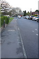
Newmans Lane looking towards the A1168
There is an OS benchmark Image on the kerb at the bottom centre of the image.
Image: © Roger Templeman
Taken: 21 Apr 2012
0.21 miles
5

Angel statue on a gravestone, St John's Church cemetery
Image: © Tim Westcott
Taken: 24 May 2008
0.21 miles
6
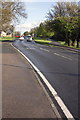
Rectory Lane (A1168) south of Newmans Lane junction
There is an OS benchmark Image on the kerb near the bottom of the image.
Image: © Roger Templeman
Taken: 21 Apr 2012
0.24 miles