
IMAGES TAKEN NEAR TO
Duck Hill, HEBDEN BRIDGE, HX7 8RD
Introduction
This page details the photographs taken nearby to Duck Hill, HX7 8RD by members of the Geograph project.
The Geograph project started in 2005 with the aim of publishing, organising and preserving representative images for every square kilometre of Great Britain, Ireland and the Isle of Man.

There are currently over 7.5m images from over14,400 individuals and you can help contribute to the project by visiting https://www.geograph.org.uk
Image Map
Images are licensed for reuse under creativecommons.org/licenses/by-sa/2.0
Notes
- Clicking on the map will re-center to the selected point.
- The higher the marker number, the further away the image location is from the centre of the postcode.
Image Listing (22 Images Found)
Images are licensed for reuse under creativecommons.org/licenses/by-sa/2.0
Image
Details
Distance
1
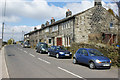
Duck Hill, Hebden Bridge
Row of houses named Duck Hill, alongside Keighley Road (A6033)
Image: © David Martin
Taken: 2 Apr 2009
0.03 miles
2
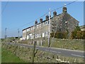
New Delight, Keighley Road, Crimsworth
The top-most houses of the hamlet, probably built for handloom weavers.
Image: © Humphrey Bolton
Taken: 2 Apr 2009
0.03 miles
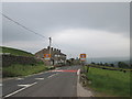
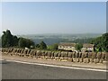
5
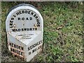
Old milestone
On the east side of the A6033 opposite Crimsworth Lane. One of the 615 milestones erected for the West Riding CC in 1893/94 all over the old West Riding. This post is quite sunken in the verge. When first set up the metal attachment would have been 100cm (over 3 feet) above ground level. All the inscription can still be read. This stone was painted in 2012 by Wadsworth Parish Council. It is Grade II listed 424782.
Image: © Robert Glover
Taken: 11 Nov 2020
0.14 miles
6
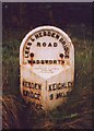
Old Milestone, A6033, Keighley Road
Opposite Crimsworth Lane. Located on the East side of road, on narrow verge on slight bend. Metal plate attached to stone post, Brayshaw & Booth casting design, 19th century. Alternative views see http://www.geograph.org.uk/photo/6741903 & http://www.geograph.org.uk/photo/32991
Inscription reads: HEBDEN / BRIDGE / 2 MILES // KEIGHLEY / 9 MILES // LEES & HEBDEN BRIDGE / ROAD / WADSWORTH // BRAYSHAW & BOOTH / MAKERS / LIVERSEDGE
Grade II listed by Historic England. see https://historicengland.org.uk/listing/the-list/list-entry/1265491
Milestone Society National ID: YW_KEHB09
Image: © Christine Minto
Taken: 30 Jan 2006
0.14 miles
7
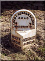
Milestone, Pecket Well
On the eastern side of Keighley Road.
Image: © Mark Anderson
Taken: 3 Aug 2005
0.15 miles
8
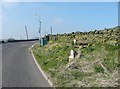
Milestone and seat, Keighley Road, Wadsworth
Also a weather station on a pole, presumably to warn of adverse conditions in Winter. I think the bus stop is on a separate pole a little further away. It is 9 miles to Keighley.
Image: © Humphrey Bolton
Taken: 2 Apr 2009
0.15 miles
9
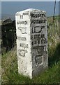
Guide stone, Keighley Road, Wadsworth
At the fork between Old Road and Keighley Road. The old road becomes a track as it crosses over the watershed to Haworth. It was superseded by the present main road around 1814. See also Image
Image: © Humphrey Bolton
Taken: 2 Apr 2009
0.16 miles
10
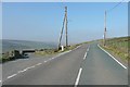
Keighley Road A6033, Wadsworth
The old road descends about 30m into the valley, then climbs steeply over the ridge, whilst the turnpike road that replaced it around 1814 keeps on climbing steadily. See Image for the guide stone.
Image: © Humphrey Bolton
Taken: 2 Apr 2009
0.16 miles