
IMAGES TAKEN NEAR TO
Wadsworth, HEBDEN BRIDGE, HX7 8PH
Introduction
This page details the photographs taken nearby to HX7 8PH by members of the Geograph project.
The Geograph project started in 2005 with the aim of publishing, organising and preserving representative images for every square kilometre of Great Britain, Ireland and the Isle of Man.

There are currently over 7.5m images from over14,400 individuals and you can help contribute to the project by visiting https://www.geograph.org.uk
Image Map
Images are licensed for reuse under creativecommons.org/licenses/by-sa/2.0
Notes
- Clicking on the map will re-center to the selected point.
- The higher the marker number, the further away the image location is from the centre of the postcode.
Image Listing (116 Images Found)
Images are licensed for reuse under creativecommons.org/licenses/by-sa/2.0
Image
Details
Distance
1

The former Mount Skip Inn
This was a favourite country pub of mine in the 1990s - a Timothy Taylors house - but is now a bed-and-breakfast establishment.
Image: © Stephen Craven
Taken: 16 Feb 2019
0.01 miles

3

Old Guide Stone by Height Road, Hebden Royd parish
Stone post by the UC road, in parish of Hebden Royd (Calderdale District), junction of Wadsworth Lane/Height Road/Nook Lane, opposite Mount Skip B & B ex PH and edge of golf course.
Grade II listed.
List Entry Number: 1229487 https://historicengland.org.uk/listing/the-list/list-entry/1229487
Surveyed
Milestone Society National ID: YW_XHEBf
Image: © Milestone Society
Taken: Unknown
0.02 miles
4

Guidestone at junction of Height Road and Wadsworth Lane
This has been decapitated; ‘Hebden’ and ‘Pecket’ have gone, leaving ‘Bridge’ and ‘Well’. The stone has been turned through a right-angle, so that ‘Bridge’ points towards Midgley. There should be another inscription, ‘ Midgley’, I shall have to have another look.
Image: © Humphrey Bolton
Taken: 11 Dec 2012
0.02 miles
5

Guide stone at Mount Skip
This has been turned through a right-angle and had its head chopped off, so that 'Hebden' is missing from the left face and 'Pecket' from the right face.
Image: © Humphrey Bolton
Taken: 7 Oct 2013
0.03 miles
6

Old guidestone
In the hills north east of Hebden Bridge. At the junction of Height Road, Wadsworth Road to the left and Nook Lane up the hill to the right. Near this junction is the ex PH, Mount Skip Inn, now a B & B. From the inscriptions it may have lost its top section at some time. This face should read HEBDEN/BRIDGE and the other face PECKET/WELL.
Image: © Robert Glover
Taken: 16 Nov 2020
0.03 miles
7
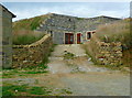
The reservoir house, Mount Skip
An unusual conversion.
Image: © Humphrey Bolton
Taken: 7 Oct 2013
0.03 miles
8
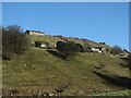
Hillside buildings
The south facing slopes overlooking Calderdale have dwellings at various levels, served by minor roads, lanes and trackways. Some are obviously farmhouses, but others are more modest cottages, often with plenty of upper floor windows which would suggest that they may have been weaver's cottages.
Image: © Gordon Hatton
Taken: 25 Jan 2017
0.06 miles
10
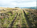
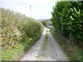
The lower branch of Hebden Royd FP23
This is a cart track up from Height Road to the Golf Club entrance.
Image: © Humphrey Bolton
Taken: 7 Oct 2013
0.07 miles