IMAGES TAKEN NEAR TO
Princess Street, HEBDEN BRIDGE, HX7 8HG
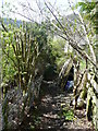
Introduction
This page details the photographs taken nearby to Princess Street, HX7 8HG by members of the Geograph project.
The Geograph project started in 2005 with the aim of publishing, organising and preserving representative images for every square kilometre of Great Britain, Ireland and the Isle of Man.

There are currently over 7.5m images from over14,400 individuals and you can help contribute to the project by visiting https://www.geograph.org.uk
Image Map
Images are licensed for reuse under creativecommons.org/licenses/by-sa/2.0
Notes
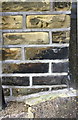
- Clicking on the map will re-center to the selected point.
- The higher the marker number, the further away the image location is from the centre of the postcode.
Image Listing (279 Images Found)
Images are licensed for reuse under creativecommons.org/licenses/by-sa/2.0
Image
Details
Distance
1
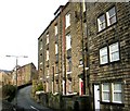
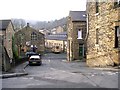
Hebden Bridge streets
A view of Lee Mill Road in Nutclough. Montrose Buildings are on the west side of the street.
Image: © Bobby Clegg
Taken: 10 Jul 2014
0.01 miles
2
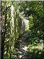
Path from Lees Road to Unity Street
This is at the Unity Street end. It is one of the little urban snickets that are not on the rights-of-way map.
Image: © Humphrey Bolton
Taken: 21 Apr 2015
0.01 miles
3
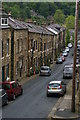
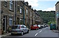
Unity Street from Keighley Road, Hebden Bridge
Image: © Christopher Hilton
Taken: 27 May 2014
0.02 miles
5
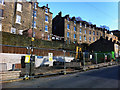
Building site on Foster Lane, Hebden Bridge
Pennine Housing 2000 are to erect three new houses on this small site. The properties will be available to rent. Behind are examples for the over and under dwellings for which Hebden Bridge is well known.
Image: © Phil Champion
Taken: 19 Feb 2012
0.02 miles
6
Building site on Foster Lane, Hebden Bridge
Pennine Housing 2000 are to erect three new houses on this small site. The properties will be available to rent. Behind are examples for the over and under dwellings for which Hebden Bridge is well known.
Image: © Phil Champion
Taken: 19 Feb 2012
0.02 miles
7
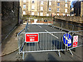
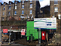
Barriers blocking Palestine Road, Hebden Bridge
Looking up hill to a small building site on Foster Lane. It's not clear why the road is fenced off, but I presume it has to do with the development.
Image: © Phil Champion
Taken: 19 Feb 2012
0.02 miles
8
Footpath from Lees Road to Unity Street
This is looking downwards from just below Lees Road. See also Image
Image: © Humphrey Bolton
Taken: 21 Apr 2015
0.03 miles
9
Benchmark on #1 Broughton Street (Palestine Road face)
Ordnance Survey cut mark benchmark described on the Bench Mark Database at www.bench-marks.org.uk/bm70071
Image: © Luke Shaw
Taken: 26 Aug 2017
0.03 miles