
IMAGES TAKEN NEAR TO
Old Town Mill Lane, HX7 8FF
Introduction
This page details the photographs taken nearby to Old Town Mill Lane, HX7 8FF by members of the Geograph project.
The Geograph project started in 2005 with the aim of publishing, organising and preserving representative images for every square kilometre of Great Britain, Ireland and the Isle of Man.

There are currently over 7.5m images from over14,400 individuals and you can help contribute to the project by visiting https://www.geograph.org.uk
Image Map
Images are licensed for reuse under creativecommons.org/licenses/by-sa/2.0
Notes
- Clicking on the map will re-center to the selected point.
- The higher the marker number, the further away the image location is from the centre of the postcode.
Image Listing (92 Images Found)
Images are licensed for reuse under creativecommons.org/licenses/by-sa/2.0
Image
Details
Distance
1
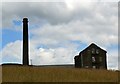
Old Town Mill, Chiserley #2
A view of the weaving shed and chimney from Fearney Fields.
Image: © Bobby Clegg
Taken: 10 Jul 2014
0.01 miles
2

Old Town Mill, Chiserley
A view of the entrance to Old Town Mill. The wrought iron gates look as though they may be the original ones. An angle grinder and a lick of paint would restore them to tip top condition.
Image: © Bobby Clegg
Taken: 10 Jul 2014
0.01 miles
3
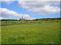
Old Town Mill
Mitchell Brothers' Mill at Old Town seen across fields of buttercups.
Image: © John Illingworth
Taken: 21 May 2014
0.01 miles
4
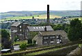
Chiserley
Old Town Mill in Chiserley viewed from the track leading from Parrock Lane to Rock Edge.
Image: © Bobby Clegg
Taken: 10 Jul 2014
0.01 miles
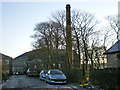
6
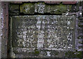
Plaque on Old Town Mill Road, Old Town
"This is the site where the ancient watercourse crossed the Old Town road. All the water flowing down the channel on to Old Town Hall Estate." This seems to be the original arrangement before the flow was divided.
Image: © Humphrey Bolton
Taken: 20 Mar 2021
0.03 miles
7
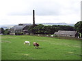
Old Town Mill and Cricket Club
Looking Southwest from Parrock Lane. Stoodley Pike can be seen in the distance.
Image: © Mark Anderson
Taken: 3 Aug 2005
0.04 miles
8
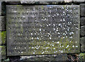
Water supply division stone, Old Town Mill Road, Old Town
This plaque reads: "This is the No.2. division Stone which divided the Brigwellhead water: one part equal to a six inch pipe for Old Town Mills & the remainder for Old Town Hall Estate. This division stone was placed in the Ancient watercourse by Henry Mitchell, A.D.1851 when he erected Old Town Shed."
Image: © Humphrey Bolton
Taken: 20 Mar 2021
0.06 miles
9
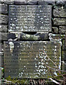
Water supply plaques, Old Town Mill Road, Old Town
The top plaque reads: "This is the spout and site of the Owler Syke & ancient watercourse over which Brigwellhead water has flowed continuously from AD1600 until AD1900 when it was turned into Old Town Reservoir by WMHY & John Cousin Mitchell" The lower plaque reads: "This is the No.1. division stone which until A.D.1900 divided the Brigwellhead water. One part flowing to Boston Hill & the remainder to Old Town Hall Estates. This division stone was placed in Ancient watercourse at the A.D.1836. joint expense of John Cousin of Old Town Hall & Wm Cousin of Boston Hill A.D.1836."
Image: © Humphrey Bolton
Taken: 20 Mar 2021
0.06 miles
10
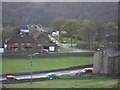
Boston Hill Estate, Old Town, Hebden Bridge
In the midground are early 1950s semi-detached private houses that back onto Old Town Cricket Club which is to the left and out of shot. The building in right foreground is Waterloo Bank, a Victorian Terrace. The photo was taken from the edge of the quarries to the SW of Wall Stone Flat. Beyond the houses known as Boston Hill is a steep hillside. The stand of fir trees amongst the deciduous woods is at Upper Lee, 0.9km away from the photographer.
Image: © charlieboyce
Taken: 25 Apr 2010
0.07 miles