IMAGES TAKEN NEAR TO
Blackshaw Head, HEBDEN BRIDGE, HX7 7JR
Introduction
This page details the photographs taken nearby to HX7 7JR by members of the Geograph project.
The Geograph project started in 2005 with the aim of publishing, organising and preserving representative images for every square kilometre of Great Britain, Ireland and the Isle of Man.

There are currently over 7.5m images from over14,400 individuals and you can help contribute to the project by visiting https://www.geograph.org.uk
Image Map
Images are licensed for reuse under creativecommons.org/licenses/by-sa/2.0
Notes
- Clicking on the map will re-center to the selected point.
- The higher the marker number, the further away the image location is from the centre of the postcode.
Image Listing (13 Images Found)
Images are licensed for reuse under creativecommons.org/licenses/by-sa/2.0
Image
Details
Distance
1
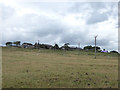
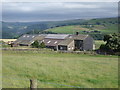
Higher and Far Rawtenstall
Viewed from Winter's Lane.
Image: © Stephen Craven
Taken: 28 Jul 2018
0.00 miles
3
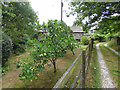
Apples, Lower Rawtenstall
A fine and early crop.
Image: © Stephen Craven
Taken: 28 Jul 2018
0.16 miles
4
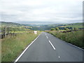
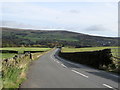
Badger Lane, Rawtonstall
About to commence the steep descent towards Hebden Bridge.
Image: © JThomas
Taken: 16 Jul 2016
0.20 miles
5
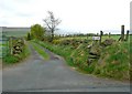
New Lane, Blackshaw
An interesting bridleway that contours around the hillside high above Charlestown, with a branch that gives an alternative route to Rawtenstall Bank.
Image: © Humphrey Bolton
Taken: 6 May 2010
0.21 miles
6
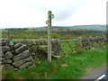
Stile opposite New Lane, Blackshaw
This footpath curves round to follow the south side of Colden Clough.
Image: © Humphrey Bolton
Taken: 6 May 2010
0.21 miles
7
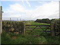
Footpath to Jack Bridge
Note the cut benchmark on the left hand gatepost
Image: © John Slater
Taken: 1 Oct 2014
0.22 miles