
IMAGES TAKEN NEAR TO
King Street, HEBDEN BRIDGE, HX7 6LU
Introduction
This page details the photographs taken nearby to King Street, HX7 6LU by members of the Geograph project.
The Geograph project started in 2005 with the aim of publishing, organising and preserving representative images for every square kilometre of Great Britain, Ireland and the Isle of Man.

There are currently over 7.5m images from over14,400 individuals and you can help contribute to the project by visiting https://www.geograph.org.uk
Image Map
Images are licensed for reuse under creativecommons.org/licenses/by-sa/2.0
Notes
- Clicking on the map will re-center to the selected point.
- The higher the marker number, the further away the image location is from the centre of the postcode.
Image Listing (201 Images Found)
Images are licensed for reuse under creativecommons.org/licenses/by-sa/2.0
Image
Details
Distance
1
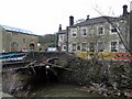
Stubbing Wharf Bridge Flood Damage
This bridge had a lucky escape in the 2015 Boxing Day floods with loss of some parapet and walling to River Calder. The bridge is the only road access to the pub and other properties along the canal & river
Image: © Kevin Waterhouse
Taken: 30 Dec 2015
0.01 miles
2
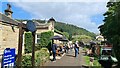
The Stubbing Wharf beside the Rochdale Canal
Boat trips available
Image: © Chris Morgan
Taken: 29 Aug 2024
0.02 miles
3
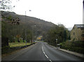
King Street heading towards Hebden Bridge
Image: © Peter Bond
Taken: 7 Nov 2011
0.02 miles
4
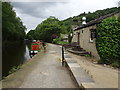
Rochdale Canal - next to the Stubbing Wharf pub
Image: © Nigel Thompson
Taken: 17 Jul 2018
0.02 miles
5
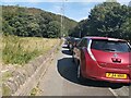
Cars parked along King Street, Mytholm, Hebden Bridge
It's unusual to see cars parked along this stretch of the A646. However, measures to aid social distancing on streets in the town centre have included removing parking bays on Old Gate and Crown Street. That may have displaced visitor parking to other locations.
Image: © Phil Champion
Taken: 13 Sep 2020
0.02 miles
6
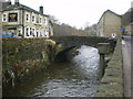
Bridge over River Calder
Giving access from King Street to Stubbings Wharf
Image: © Alexander P Kapp
Taken: 26 Jan 2009
0.02 miles
7
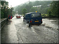
Flooding on King Street, Mytholm
On 2nd July 2006 torrential rain caused flooding throughout the Upper Calder Valley. The main road along the valley was blocked in a number of places; here the road was just about passable with care after the rain had stopped.
Image: © Phil Champion
Taken: 2 Jul 2006
0.03 miles
8
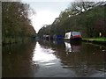
On The Rochdale Canal
In October 2011. No crowds and time to appreciate the trip. A telephone call secured a trip for me and the missus, only us, brilliant.
Image: © David Clark
Taken: 14 Oct 2011
0.03 miles
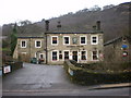
10
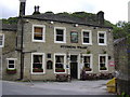
Stubbing Wharf off Halifax Road
River Calder runs at the front. The Rochdale Canal runs to the rear of the building
Image: © Robert Wade
Taken: 29 Jun 2007
0.03 miles