
IMAGES TAKEN NEAR TO
Bridge Lanes, HEBDEN BRIDGE, HX7 6AT
Introduction
This page details the photographs taken nearby to Bridge Lanes, HX7 6AT by members of the Geograph project.
The Geograph project started in 2005 with the aim of publishing, organising and preserving representative images for every square kilometre of Great Britain, Ireland and the Isle of Man.

There are currently over 7.5m images from over14,400 individuals and you can help contribute to the project by visiting https://www.geograph.org.uk
Image Map
Images are licensed for reuse under creativecommons.org/licenses/by-sa/2.0
Notes
- Clicking on the map will re-center to the selected point.
- The higher the marker number, the further away the image location is from the centre of the postcode.
Image Listing (379 Images Found)
Images are licensed for reuse under creativecommons.org/licenses/by-sa/2.0
Image
Details
Distance
1
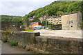
View from Rochdale Canal towpath towards Bridge Lanes houses
There is an Ordnance Survey benchmark Image on a vertical stone in the towpath-side wall
Image: © Roger Templeman
Taken: 19 Aug 2017
0.01 miles
2
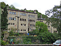
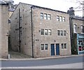
Top-and-bottom houses, Hebden Bridge
The arrangement of a house entered from the top road, above another entered from the lower road, is not unique to Hebden Bridge, but this town built on steep hillsides has plenty of examples. This row on Bridges Lane (top) / River Street (bottom) is listed grade II (list entry 1228915).
Image: © Stephen Craven
Taken: 28 Jul 2018
0.01 miles
3
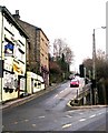
Junction of Heptonstall Road and the A646
Traffic heading towards the centre of Hebden Bridge from Heptonstall is prevented from turning left and must instead use the Image
Image: © Betty Longbottom
Taken: 31 Jan 2009
0.02 miles
4
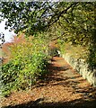
Stoney Lane in Autumn
A quiet path in Hebden Bridge
Image: © Kevin Waterhouse
Taken: 31 Oct 2018
0.02 miles
5
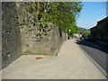
Retaining wall, Bridge Lanes, Hebden Bridge
This wall replaces a row of four-storey buildings comprising houses on two levels - the lower houses back-to-earth and the upper houses having access at the back, from High Street.
Image: © Humphrey Bolton
Taken: 9 May 2016
0.03 miles
7
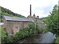
River Calder, upstream from Stubbing Holme Road
The chimney doesn't belong to the buildings in the foreground but to the former Calder Cotton Mill.
Image: © Stephen Craven
Taken: 28 Jul 2018
0.03 miles
9
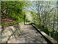
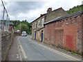
Stony Lane, formerly High Street, Hebden Bridge
It is difficult to imagine how this street looked until the 1960s, when the four-storey houses on the left, and the houses on the right, which had two storeys on this side and four facing Bridge Lanes, were demolished. The Calder Valley Community Land Trust is investigating whether some new houses can now be built on the land. They have produced a booklet with the history of the site and fascinating photographs of the old houses before and during demolition. http://caldervalleyclt.org.uk/
Image: © Humphrey Bolton
Taken: 9 May 2016
0.03 miles
10
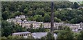
Hebble End panorama
The stone circular chimney belongs to Calder Mill. Across the River Calder are a row of up and under terraces on the A646 Burnley Road.
Image: © Bobby Clegg
Taken: 17 Sep 2015
0.03 miles