
IMAGES TAKEN NEAR TO
Green Bank, HEBDEN BRIDGE, HX7 5TP
Introduction
This page details the photographs taken nearby to Green Bank, HX7 5TP by members of the Geograph project.
The Geograph project started in 2005 with the aim of publishing, organising and preserving representative images for every square kilometre of Great Britain, Ireland and the Isle of Man.

There are currently over 7.5m images from over14,400 individuals and you can help contribute to the project by visiting https://www.geograph.org.uk
Image Map
Images are licensed for reuse under creativecommons.org/licenses/by-sa/2.0
Notes
- Clicking on the map will re-center to the selected point.
- The higher the marker number, the further away the image location is from the centre of the postcode.
Image Listing (94 Images Found)
Images are licensed for reuse under creativecommons.org/licenses/by-sa/2.0
Image
Details
Distance
1
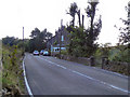
Cragg Vale
Blackstone Edge Road (B6138) at Cragg Vale.
Image: © David Dixon
Taken: 2 Sep 2010
0.00 miles
3
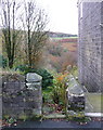
Hebden Royd FP119 at Blackstone Edge Road
The path starts at the south-western end of the row of houses called Green Bank, and passes through the garden of the end house. There is a signpost on the other side of the road. Neither the houses nor the path are shown on the 1850 six-inch map, but they are both on the 1893 1:2500 map.
Image: © Humphrey Bolton
Taken: 20 Oct 2014
0.01 miles
5
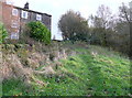
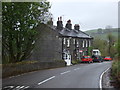
Hebden Royd FP119 approaching Green Bank
The row of houses called Green Bank. on Blackstone Edge Road, was perhaps named after the green grass on the hillside below it.
Image: © Humphrey Bolton
Taken: 20 Oct 2014
0.02 miles
6
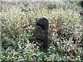
Carved Gate Stoop
An unusually carved stoop now very redundant.
Image: © Michael Steele
Taken: 22 Sep 2009
0.02 miles
8
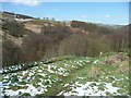
Footpath and water channel below Green Bank, Cragg Vale
The channel conveyed water from Turvin Clough along the hillside to Turvin Mills.
Image: © Humphrey Bolton
Taken: 5 Apr 2012
0.02 miles
9
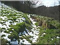
Water channel below Green Bank, Cragg Vale
The footpath used to cross the channel by a footbridge, but there is no flow now and the channel has been filled in under the path and downstream.
Image: © Humphrey Bolton
Taken: 5 Apr 2012
0.02 miles
10
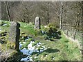
Gateway on the footpath below Green Bank, Cragg Vale
The path comes between the gateposts from the left, and then goes straight down the hillside, down a long flight of stone steps.
Image: © Humphrey Bolton
Taken: 5 Apr 2012
0.03 miles