
IMAGES TAKEN NEAR TO
Raw Lane, HEBDEN BRIDGE, HX7 5RF
Introduction
This page details the photographs taken nearby to Raw Lane, HX7 5RF by members of the Geograph project.
The Geograph project started in 2005 with the aim of publishing, organising and preserving representative images for every square kilometre of Great Britain, Ireland and the Isle of Man.

There are currently over 7.5m images from over14,400 individuals and you can help contribute to the project by visiting https://www.geograph.org.uk
Image Map
Images are licensed for reuse under creativecommons.org/licenses/by-sa/2.0
Notes
- Clicking on the map will re-center to the selected point.
- The higher the marker number, the further away the image location is from the centre of the postcode.
Image Listing (88 Images Found)
Images are licensed for reuse under creativecommons.org/licenses/by-sa/2.0
Image
Details
Distance
1
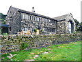
Wadsworth Royd Farmhouse
This Grade II listed building has been refurbished recently. The listing details state that it was built in the 16C, with 19C alterations. The windows suggest that there was a weaving workshop on the first floor. Hebden Royd FP31 passes alongside the wall in the foreground.
Image: © Humphrey Bolton
Taken: 2 Sep 2013
0.01 miles
2
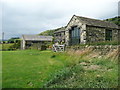
New houses at Wadsworth Royd
The old house in the centre is listed Grade II, and stated to have been built in the late 16C. Hebden Royd FP31 goes along the edge of the field.
Image: © Humphrey Bolton
Taken: 14 Jul 2014
0.02 miles
3
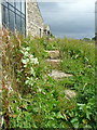
Steps on Hebden Royd FP31 at Wadsworth Royd
Image: © Humphrey Bolton
Taken: 14 Jul 2014
0.02 miles
4
Nettles on Hebden Royd FP30, Mytholmroyd
Image: © Humphrey Bolton
Taken: 15 Sep 2011
0.03 miles
5
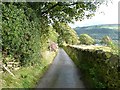
Driveway to Wadsworth Banks Farm, Mytholmroyd
This is part of Hebden Royd FP21.
Image: © Humphrey Bolton
Taken: 8 Sep 2011
0.03 miles
6
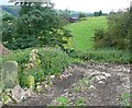
Hebden Royd FP31 near Wadsworth Royd Farm
This is the branch of the path between Hill House Farm and Birchen Lee Carr. This section goes down to cross a little valley, and has been cleared of undergrowth during the last year.
Image: © Humphrey Bolton
Taken: 10 Sep 2012
0.03 miles
7
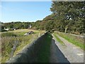
Hebden Royd FP32 on the driveway to Birchen Lee Carr
Image: © Humphrey Bolton
Taken: 15 Sep 2011
0.04 miles
8
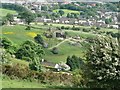
Wadsworth Royd Farm, Mytholmroyd
This is the name on the six-inch map of 1854. Seen here from Height Road.
Image: © Humphrey Bolton
Taken: 12 Jun 2010
0.04 miles
9
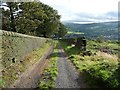
Driveway to Birchen Lee Carr, Mytholmroyd
This is part of Hebden Royd FP32.
Image: © Humphrey Bolton
Taken: 8 Sep 2011
0.04 miles
10

Japanese knotweed on Hebden Royd FP31 at Wadsworth Royd
So far you can push your way through this rampant weed, which is colonising the eastern bank of the stream at the footbridge.
Image: © Humphrey Bolton
Taken: 14 Jul 2014
0.04 miles