
IMAGES TAKEN NEAR TO
Stubbings Street, HX7 5FE
Introduction
This page details the photographs taken nearby to Stubbings Street, HX7 5FE by members of the Geograph project.
The Geograph project started in 2005 with the aim of publishing, organising and preserving representative images for every square kilometre of Great Britain, Ireland and the Isle of Man.

There are currently over 7.5m images from over14,400 individuals and you can help contribute to the project by visiting https://www.geograph.org.uk
Image Map
Images are licensed for reuse under creativecommons.org/licenses/by-sa/2.0
Notes
- Clicking on the map will re-center to the selected point.
- The higher the marker number, the further away the image location is from the centre of the postcode.
Image Listing (328 Images Found)
Images are licensed for reuse under creativecommons.org/licenses/by-sa/2.0
Image
Details
Distance
1
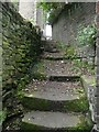
Thorn Bank Steps, Mytholmroyd
Apparently this is part of the unadopted street called Thorn Bank, so is presumably a right-of-way on foot although not shown as a public footpath on maps.
Image: © Humphrey Bolton
Taken: 9 Oct 2012
0.00 miles
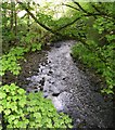
3
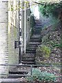
Steps at Thorn Bank, Mytholmroyd
These are an unadopted street rather than a public footpath.
Image: © Humphrey Bolton
Taken: 28 Oct 2011
0.01 miles
4
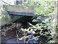
New Bridge, Mytholmroyd
This was built as part of the Blackstone Edge turnpike road in the early 19C, and replaced a ford behind the Shoulder of Mutton.
Image: © Humphrey Bolton
Taken: 28 Oct 2011
0.02 miles
5

Small green space in Mytholmroyd
There is a shelter at one side, alongside an electricity substation.
Image: © Stephen Craven
Taken: 24 Apr 2021
0.02 miles
7

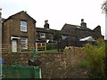
Fountain at small garden in Mytholmroyd
The garden and monument are beside the B6138/Cragg Road. The fountain was presented to the town by Charles Robertshaw in 1921.
Image: © Trevor Littlewood
Taken: 3 Jun 2015
0.02 miles
8
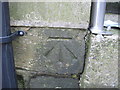
Ordnance Survey Cut Mark
Can be found in Hall Bank Lane on the side of the Methodist Church between the drain pipe and the start of some railings.
Image: © Peter Wood
Taken: 21 Jan 2012
0.03 miles
9

Tour-de-France waymark, Cragg Road, Mytholmroyd
This is at the start of the long climb up Cragg Vale to the A58. The green cabinet behind houses the controls for a sewage pumping station.
Image: © Humphrey Bolton
Taken: 9 Dec 2013
0.03 miles
10
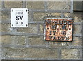
Mytholmroyd UDC WW valve marker plate, Hall Bank Lane
This plate is on the side of the Methodist chapel. I haven't found a reservoir for this water undertaking on old maps, so perhaps they bought water from Halifax or Morley and just laid and maintained the distribution mains. The distance to the valve indicated by the new plate is different, so either there are two mains or the old one has been superseded.
Image: © Humphrey Bolton
Taken: 18 Sep 2014
0.03 miles