
IMAGES TAKEN NEAR TO
Stocks Avenue, HEBDEN BRIDGE, HX7 5BD
Introduction
This page details the photographs taken nearby to Stocks Avenue, HX7 5BD by members of the Geograph project.
The Geograph project started in 2005 with the aim of publishing, organising and preserving representative images for every square kilometre of Great Britain, Ireland and the Isle of Man.

There are currently over 7.5m images from over14,400 individuals and you can help contribute to the project by visiting https://www.geograph.org.uk
Image Map
Images are licensed for reuse under creativecommons.org/licenses/by-sa/2.0
Notes
- Clicking on the map will re-center to the selected point.
- The higher the marker number, the further away the image location is from the centre of the postcode.
Image Listing (182 Images Found)
Images are licensed for reuse under creativecommons.org/licenses/by-sa/2.0
Image
Details
Distance
1
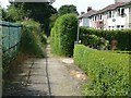
Housing estate path, Mytholmroyd
This is the 'back path' for Erringden Road, although it looks as if the fronts of the houses face it. Like many such paths in housing estate it is not a public right of way.
Image: © Humphrey Bolton
Taken: 28 Jul 2011
0.06 miles
2
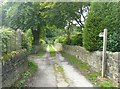
Footpath off Nest Lane, Mytholmroyd
A lane at first, then a field path leading straight up a ridge to the moors.
Image: © Humphrey Bolton
Taken: 27 Aug 2009
0.06 miles
3
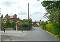
Nest Lane, Mytholmroyd
Nest is now called Throstle Nest, and is a farm 200m up the lane on the lane. A little way beyond it the road name changes to Park Lane, and leads to Park Farm.
Image: © Humphrey Bolton
Taken: 27 Aug 2009
0.06 miles
4
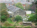
Houses at Throstle Nest Farm
Presumably Nest lane is named after this farm, which was simply called 'Nest' on the 1850 six-inch map. These houses are probably later than the building shown here on that map, and I suspect that the farmhouse is out-of-sight behind the trees to the left.
Image: © Humphrey Bolton
Taken: 18 Sep 2014
0.08 miles
5
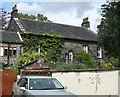
Stocks, Mytholmroyd
Formerly a farmhouse. It has a Venetian window at the front, and also in the gable. The attached cottage might be older. There is also a building with ventilators on the roof, possibly built as a workshop.
Image: © Humphrey Bolton
Taken: 27 Aug 2009
0.08 miles
6
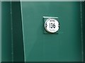
Plaque on Footbridge MVN2 136, Mytholmroyd
This gives the distance, presumably from Manchester Victoria: 24 miles 50 chains. A chain is 22 yards, derived from a surveyor's measuring chain. The 'N' stands for Normanton, but why the '2'?
Image: © Humphrey Bolton
Taken: 28 Jul 2011
0.08 miles
7
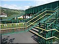
Footbridge MVN2 136, Mytholmroyd
This takes Hebden Royd Footpath 52 over the Manchester Victoria to Normanton railway. It is all that is left of the footpath, the parts to the north and south having become housing estate roads.
Image: © Humphrey Bolton
Taken: 28 Jul 2011
0.08 miles
8

Footpath between Cragg Road and Stocks Lane
The steps are at the bottom of a flight of about 30. This path somehow missed being put on the rights-of-way map.
Image: © Humphrey Bolton
Taken: 28 Oct 2011
0.10 miles
9

Erringden Road, Mytholmroyd
Off The Drive.
Image: © Richard Vince
Taken: 10 Apr 2026
0.11 miles
10
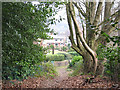
Coming down into Mytholmroyd
The end of the footpath that has descended over 2.5km from Johnny's Gap, as it enters Mytholmroyd.
Image: © Stephen Craven
Taken: 30 Dec 2008
0.11 miles