IMAGES TAKEN NEAR TO
Ripponden, SOWERBY BRIDGE, HX6 4NX
Introduction
This page details the photographs taken nearby to HX6 4NX by members of the Geograph project.
The Geograph project started in 2005 with the aim of publishing, organising and preserving representative images for every square kilometre of Great Britain, Ireland and the Isle of Man.

There are currently over 7.5m images from over14,400 individuals and you can help contribute to the project by visiting https://www.geograph.org.uk
Image Map
Images are licensed for reuse under creativecommons.org/licenses/by-sa/2.0
Notes
- Clicking on the map will re-center to the selected point.
- The higher the marker number, the further away the image location is from the centre of the postcode.
Image Listing (30 Images Found)
Images are licensed for reuse under creativecommons.org/licenses/by-sa/2.0
Image
Details
Distance
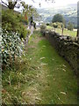
1
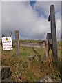
Footpath
From Cross Wells Road the Smith Lane
Image: © Alexander P Kapp
Taken: 8 Apr 2010
0.07 miles
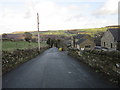
3
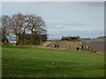
Flat Head Farm, Cross Wells Road Ripponden
Image: © Alexander P Kapp
Taken: 8 Apr 2010
0.11 miles
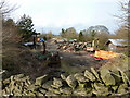
4
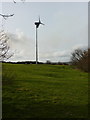
Wind turbine
To the west of Flat Head Delph
Image: © Alexander P Kapp
Taken: 8 Apr 2010
0.12 miles
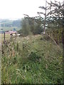
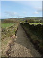
7
Footpath
From Cross Wells Road the Smith Lane
Image: © Alexander P Kapp
Taken: 8 Apr 2010
0.12 miles