IMAGES TAKEN NEAR TO
Ripponden, SOWERBY BRIDGE, HX6 4NP
Introduction
This page details the photographs taken nearby to HX6 4NP by members of the Geograph project.
The Geograph project started in 2005 with the aim of publishing, organising and preserving representative images for every square kilometre of Great Britain, Ireland and the Isle of Man.

There are currently over 7.5m images from over14,400 individuals and you can help contribute to the project by visiting https://www.geograph.org.uk
Image Map
Images are licensed for reuse under creativecommons.org/licenses/by-sa/2.0
Notes
- Clicking on the map will re-center to the selected point.
- The higher the marker number, the further away the image location is from the centre of the postcode.
Image Listing (36 Images Found)
Images are licensed for reuse under creativecommons.org/licenses/by-sa/2.0
Image
Details
Distance
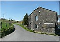
1
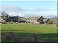
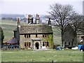
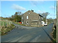
Great House Farm, Soyland -
A house in 17C style on the left, whilst the one on the right looks late 19C, and has a circular window in the gable end.
Image: © Humphrey Bolton
Taken: 11 Mar 2012
0.01 miles
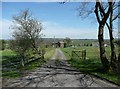
5
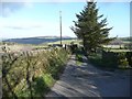
Gough Lane, Soyland
This is Ripponden Footpath 14. Footpath 12 goes to the left at the signpost and to the right at the waymark in the foreground.
Image: © Humphrey Bolton
Taken: 11 Mar 2012
0.07 miles
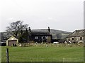
6
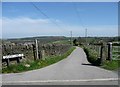
Gough Lane
This leads past the farm called Gough to Wood End, and a track down to Mill Bank village. It is a public footpath and part of the Calderdale Way.
Image: © Humphrey Bolton
Taken: 6 May 2013
0.08 miles
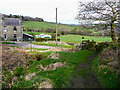
7
Eccles Parlour at the junction with New Road
Eccles Parlour is part of the Calderdale Way.
Image: © Humphrey Bolton
Taken: 6 May 2013
0.10 miles
8
Footpath passing Water Houses, near Cotton Stones
This is Footpath 07/13/1.
Image: © Humphrey Bolton
Taken: 8 Apr 2021
0.10 miles
9
The junction of Eccles Parlour and Lighthazles Road
Image: © Nigel Homer
Taken: 17 Feb 2007
0.11 miles
10
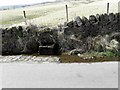
Overflowing Water Trough in Lighthazles Road
Image: © Michael Steele
Taken: 10 Apr 2010
0.12 miles