IMAGES TAKEN NEAR TO
Mount Pleasant, SOWERBY BRIDGE, HX6 4JL
Introduction
This page details the photographs taken nearby to Mount Pleasant, HX6 4JL by members of the Geograph project.
The Geograph project started in 2005 with the aim of publishing, organising and preserving representative images for every square kilometre of Great Britain, Ireland and the Isle of Man.

There are currently over 7.5m images from over14,400 individuals and you can help contribute to the project by visiting https://www.geograph.org.uk
Image Map
Images are licensed for reuse under creativecommons.org/licenses/by-sa/2.0
Notes
- Clicking on the map will re-center to the selected point.
- The higher the marker number, the further away the image location is from the centre of the postcode.
Image Listing (91 Images Found)
Images are licensed for reuse under creativecommons.org/licenses/by-sa/2.0
Image
Details
Distance
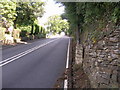
1
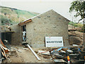
Water pumping station, Ripponden Bank
The pumping station under construction but nearly complete. It takes treated water from the service reservoir on the west side of the valley Image and delivers it to the one higher up the east side Image
Image: © Stephen Craven
Taken: 24 Aug 1990
0.03 miles
2
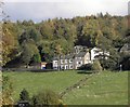
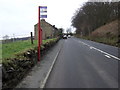
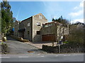
Houses on Ripponden New Bank
The photograph is taken from Small Lees Mill, off Oldham Road.
Image: © Michael Steele
Taken: 24 Oct 2010
0.03 miles
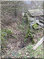
5
Fiddle Lane - looking towards Ripponden New Bank
Image: © Betty Longbottom
Taken: 18 Mar 2015
0.06 miles
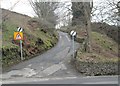
10
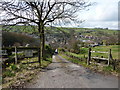
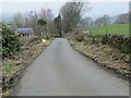
Road to The Clough, Cob Cottage and The Cob
Image: © Alexander P Kapp
Taken: 8 Apr 2010
0.11 miles