IMAGES TAKEN NEAR TO
Church Lane, SOWERBY BRIDGE, HX6 4HZ
Introduction
This page details the photographs taken nearby to Church Lane, HX6 4HZ by members of the Geograph project.
The Geograph project started in 2005 with the aim of publishing, organising and preserving representative images for every square kilometre of Great Britain, Ireland and the Isle of Man.

There are currently over 7.5m images from over14,400 individuals and you can help contribute to the project by visiting https://www.geograph.org.uk
Image Map
Images are licensed for reuse under creativecommons.org/licenses/by-sa/2.0
Notes
- Clicking on the map will re-center to the selected point.
- The higher the marker number, the further away the image location is from the centre of the postcode.
Image Listing (86 Images Found)
Images are licensed for reuse under creativecommons.org/licenses/by-sa/2.0
Image
Details
Distance
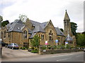
4
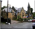
Former Church - Oldham Road, Ripponden
Now apartments.
Image: © Betty Longbottom
Taken: 30 Sep 2008
0.04 miles
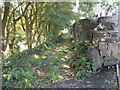
7
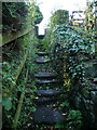
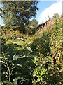
Footpath
From Hollins Lane to Rochdale Road
Image: © Alexander P Kapp
Taken: 12 Nov 2008
0.05 miles
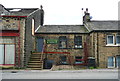
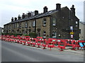
8
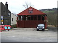
Car sales and repairs, Ripponden
On Oldham Road.
Image: © JThomas
Taken: 14 Mar 2015
0.05 miles