IMAGES TAKEN NEAR TO
Ryburndale, SOWERBY BRIDGE, HX6 4HD
Introduction
This page details the photographs taken nearby to Ryburndale, HX6 4HD by members of the Geograph project.
The Geograph project started in 2005 with the aim of publishing, organising and preserving representative images for every square kilometre of Great Britain, Ireland and the Isle of Man.

There are currently over 7.5m images from over14,400 individuals and you can help contribute to the project by visiting https://www.geograph.org.uk
Image Map
Images are licensed for reuse under creativecommons.org/licenses/by-sa/2.0
Notes
- Clicking on the map will re-center to the selected point.
- The higher the marker number, the further away the image location is from the centre of the postcode.
Image Listing (49 Images Found)
Images are licensed for reuse under creativecommons.org/licenses/by-sa/2.0
Image
Details
Distance
2
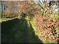
The sharp, steep bend on George lane, Rishworth
This is Ripponden Bridleway 34, and is the continuation of the Bar Lane bridleway, which unfortunately does not continue up the valley to the reservoir.
Image: © Humphrey Bolton
Taken: 15 Nov 2018
0.04 miles
3
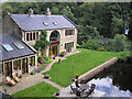
House by dam
A house built next to a mill dam in the Ryburn Valley.
Image: © John Illingworth
Taken: 8 Aug 2007
0.05 miles
4
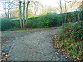
George Lane, Rishworth
This is Ripponden Bridleway 34.
Image: © Humphrey Bolton
Taken: 15 Nov 2018
0.05 miles
5
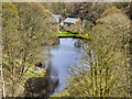
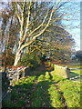
Small Lodge Below Ryburn Reservoir
Looking down from Ryburn Reservoir Dam.
Image: © David Dixon
Taken: 27 Apr 2016
0.05 miles
6
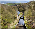
River Ryburn, Overflow from Ryburn Reservoir
Looking down from Ryburn Reservoir Dam.
Image: © David Dixon
Taken: 27 Apr 2016
0.09 miles
7
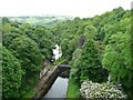
Looking downstream from the Ryburn Reservoir Dam
Image: © Humphrey Bolton
Taken: 16 Jun 2013
0.10 miles
8
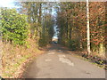
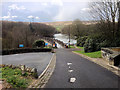
The driveway to Ryburn Reservoir, Rishworth
The view is looking up the driveway from the bend just above the car park. There are some rather vicious speed humps.
Image: © Humphrey Bolton
Taken: 15 Nov 2018
0.10 miles
9
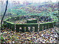
Concrete 'henge' in a disused quarry near Ryburn Reservoir, Rishworth
This is thought to have been made by the workmen when they had completed the construction of Ryburn Reservoir. The circle is made of the precast sections used to make the parapet wall of the footpath across the dam. I hope no-one was sacrificed on the large block that is pretending to be an altar.
Image: © Humphrey Bolton
Taken: 15 Nov 2018
0.11 miles
10
Approaching Ryburn Reservoir
Ryburn Reservoir is the lower of two reservoirs in the Ryburn Valley which were built by the Wakefield and District Waterworks to supply water to the town of Wakefield; the upper reservoir is Image It was also the first of the two to be built; it was completed in 1933. Its concrete dam is situated in a deep part of the valley, just outside the settlements of Ripponden and Rishworth.
Image: © David Dixon
Taken: 27 Apr 2016
0.11 miles