
IMAGES TAKEN NEAR TO
Stepping Stones, SOWERBY BRIDGE, HX6 4FD
Introduction
This page details the photographs taken nearby to Stepping Stones, HX6 4FD by members of the Geograph project.
The Geograph project started in 2005 with the aim of publishing, organising and preserving representative images for every square kilometre of Great Britain, Ireland and the Isle of Man.

There are currently over 7.5m images from over14,400 individuals and you can help contribute to the project by visiting https://www.geograph.org.uk
Image Map
Images are licensed for reuse under creativecommons.org/licenses/by-sa/2.0
Notes
- Clicking on the map will re-center to the selected point.
- The higher the marker number, the further away the image location is from the centre of the postcode.
Image Listing (70 Images Found)
Images are licensed for reuse under creativecommons.org/licenses/by-sa/2.0
Image
Details
Distance
2
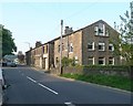
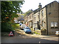
Works and houses, Oldham Road A672, Rishworth
First a pair of houses, the first with a large Venetian window to light the second floor. Then a building captioned 'Works' on the OS map, at the far end of which is another pair of houses looking little different from the frontage of the works building.
Image: © Humphrey Bolton
Taken: 12 May 2008
0.03 miles
3
Oldham Road (A672) Ripponden
Near to Excelsior Close.
Image: © David Dixon
Taken: 3 Sep 2010
0.04 miles
5
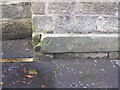
Pivot benchmark on a building on Oldham Road
Image: © John Slater
Taken: 28 Aug 2012
0.05 miles
7
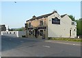
The Besom, Oldham Road A672, Rishworth
With a 'double-pile' roof, ie two parallel gables, and also a flat roofed extension at the rear.
Image: © Humphrey Bolton
Taken: 12 May 2008
0.06 miles
8

Sunken Lancashire & Yorkshire Railway boundary stone
Marking the boundary of railway land on a path by the River Ryburn and a path heading uphill to a footbridge over the railway. The railway was the Rishworth branch line from Sowerby Bridge which is now dismantled but the footbridge remains.
Image: © Kevin Waterhouse
Taken: 5 Jul 2025
0.07 miles
9
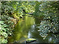
River Ryburn from Pretoria Bridge (FB)
Image: © Alexander P Kapp
Taken: 7 Aug 2009
0.08 miles
10
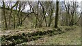
Rishworth Station Platform remains
Only visible in the winter without Himalayan Balsam and scrub growth
Image: © Kevin Waterhouse
Taken: 7 Apr 2021
0.08 miles