IMAGES TAKEN NEAR TO
Ripponden, SOWERBY BRIDGE, HX6 4ES
Introduction
This page details the photographs taken nearby to HX6 4ES by members of the Geograph project.
The Geograph project started in 2005 with the aim of publishing, organising and preserving representative images for every square kilometre of Great Britain, Ireland and the Isle of Man.

There are currently over 7.5m images from over14,400 individuals and you can help contribute to the project by visiting https://www.geograph.org.uk
Image Map
Images are licensed for reuse under creativecommons.org/licenses/by-sa/2.0
Notes
- Clicking on the map will re-center to the selected point.
- The higher the marker number, the further away the image location is from the centre of the postcode.
Image Listing (59 Images Found)
Images are licensed for reuse under creativecommons.org/licenses/by-sa/2.0
Image
Details
Distance
1
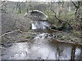
Confluence, Barkisland / Rishworth
This is the confluence of the River Ryburn, which comes from the west under Slitheroe bridge and turns south, and Booth Dean Clough to the left of the image. On the right, there is a tiny waterfall on a small stream issuing from a culvert, and in the river bed an iron pipe that is probably a sewer. It has a hatchbox with a bolted-down cover.
Image: © Humphrey Bolton
Taken: 14 Jan 2009
0.07 miles
2
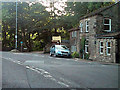
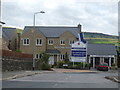
Bridge That Gap
Sandwich bar at the corner of Oldham Road and Bar Lane, Rishworth.
Image: © David Dixon
Taken: 3 Sep 2010
0.08 miles
4
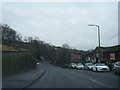
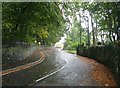
Oldham Road, Rishworth
Oldham Road (A672), passing the sign as it enters Rishworth.
Image: © David Dixon
Taken: 3 Sep 2010
0.09 miles
5
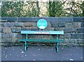
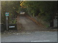
Seat from the former Rishworth Station
The plaque reads ”Rishworth Railway Station / This is the former entrance to the / trestle bridge which led to / Rishworth Railway Station / 1881 to 1952” The station had closed to passengers in 1929, after which it was a goods station.
Image: © Humphrey Bolton
Taken: 5 Nov 2012
0.09 miles
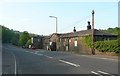
6
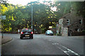
Dyson Lane - Oldham Road, Rishworth
Image: © Betty Longbottom
Taken: 30 Sep 2008
0.09 miles
9
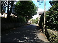
Bar Lane
Presumably marking the toll bar on the Ripponden to Oldham turnpike
Image: © Jim Thornton
Taken: 19 Oct 2006
0.10 miles
10
Industrial building, Oldham Road A672, Rishworth
There is a larger building in the valley, so perhaps this housed the offices of the factory.
Image: © Humphrey Bolton
Taken: 12 May 2008
0.10 miles