IMAGES TAKEN NEAR TO
Coronation Terrace, SOWERBY BRIDGE, HX6 4AB
Introduction
This page details the photographs taken nearby to Coronation Terrace, HX6 4AB by members of the Geograph project.
The Geograph project started in 2005 with the aim of publishing, organising and preserving representative images for every square kilometre of Great Britain, Ireland and the Isle of Man.

There are currently over 7.5m images from over14,400 individuals and you can help contribute to the project by visiting https://www.geograph.org.uk
Image Map
Images are licensed for reuse under creativecommons.org/licenses/by-sa/2.0
Notes
- Clicking on the map will re-center to the selected point.
- The higher the marker number, the further away the image location is from the centre of the postcode.
Image Listing (104 Images Found)
Images are licensed for reuse under creativecommons.org/licenses/by-sa/2.0
Image
Details
Distance
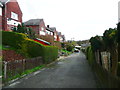
2
Wood Street
This is a very short street between Halifax Road and Jubilee Terrace. Although it looks like a driveway, it is an adopted highway.
Image: © Humphrey Bolton
Taken: 8 Apr 2014
0.04 miles
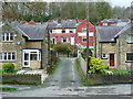
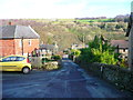
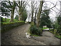
3
Cow Lane, Ripponden
This lane is an unadopted street, and is wide enough for carts but is only classed as a footpath, Ripponden 57.
Image: © Humphrey Bolton
Taken: 10 Feb 2014
0.04 miles
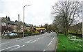
5
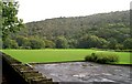
Football Pitch - Halifax Road, Kebroyd
Image: © Betty Longbottom
Taken: 1 Oct 2008
0.05 miles
6
Kenworthy Lane, Ripponden
This is a street with 'mixed status', presumably meaning that part of it is adopted and part not.
Image: © Humphrey Bolton
Taken: 10 Feb 2014
0.06 miles
8
Ripponden Wood Lane
This is a street of 'mixed status' and Ripponden Bridleway 152, which goes to the River Ryburn and then stops. The 1850 OS map doesn't show any continuation across the river, so perhaps the right-of-way was just to give access to the water.
Image: © Humphrey Bolton
Taken: 10 Feb 2014
0.07 miles
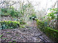
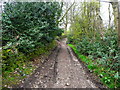
9
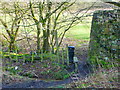
Stile and signpost on permissive footpath
This is where the path crosses from a football ground to a pasture field. It goes down the field to the riverside. It is not shown on the OS map, but presumably it follows the river to the footbridge on Highlee lane
Image: © Humphrey Bolton
Taken: 10 Feb 2014
0.08 miles
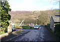
10
Cow Lane, Ripponden FP57
The driveway on the left seems to be the vehicle access to Myrtle Grove, from Kebroyd Mount. It is not a public right-of-way.
Image: © Humphrey Bolton
Taken: 31 Mar 2014
0.08 miles