IMAGES TAKEN NEAR TO
Sandal Terrace, SOWERBY BRIDGE, HX6 3QE
Introduction
This page details the photographs taken nearby to Sandal Terrace, HX6 3QE by members of the Geograph project.
The Geograph project started in 2005 with the aim of publishing, organising and preserving representative images for every square kilometre of Great Britain, Ireland and the Isle of Man.

There are currently over 7.5m images from over14,400 individuals and you can help contribute to the project by visiting https://www.geograph.org.uk
Image Map
Images are licensed for reuse under creativecommons.org/licenses/by-sa/2.0
Notes
- Clicking on the map will re-center to the selected point.
- The higher the marker number, the further away the image location is from the centre of the postcode.
Image Listing (99 Images Found)
Images are licensed for reuse under creativecommons.org/licenses/by-sa/2.0
Image
Details
Distance
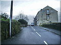
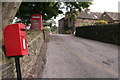
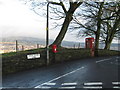
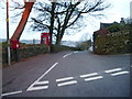
3
Spark House Lane at Sowerby Croft Lane
The classic pair; letter box and red telephone kiosk. The latter has not been listed, so we have to hope that it survives.
Image: © Humphrey Bolton
Taken: 23 Mar 2015
0.04 miles
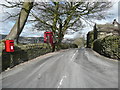
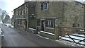
4
Lane Ends, Norland
This 17C house is listed, Grade II, and is dated 1628 according to the listing details.
Image: © Humphrey Bolton
Taken: 23 Mar 2015
0.05 miles
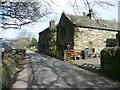
6
Farmhouse Sparkhouse Lane
An old farmhouse in rural Sowerby Bridge
Image: © warren nicholls
Taken: 28 Feb 2018
0.07 miles
7
Footpath off Sowerby Croft Lane, Sowerby Bridge
This is the top of the path shown in Image
Image: © Humphrey Bolton
Taken: 23 Aug 2015
0.09 miles
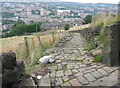
8
Footpath off Sowerby Croft Lane
This cobbled path goes down to Boggart Lane. A small part of Sowerby Bridge is getting its ten second sunny period.
Image: © Humphrey Bolton
Taken: 16 May 2013
0.09 miles
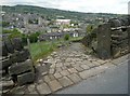
10
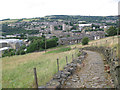
Setted path above Sowerby Bridge
The path leads down from Sowerby Croft Lane Image to Boggart Lane. The houses in the background on Clyde Street are on the line of the disused railway tunnel below.
Image: © Stephen Craven
Taken: 6 Jul 2015
0.10 miles