IMAGES TAKEN NEAR TO
Springfield, SOWERBY BRIDGE, HX6 3PZ
Introduction
This page details the photographs taken nearby to Springfield, HX6 3PZ by members of the Geograph project.
The Geograph project started in 2005 with the aim of publishing, organising and preserving representative images for every square kilometre of Great Britain, Ireland and the Isle of Man.

There are currently over 7.5m images from over14,400 individuals and you can help contribute to the project by visiting https://www.geograph.org.uk
Image Map
Images are licensed for reuse under creativecommons.org/licenses/by-sa/2.0
Notes
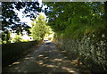
- Clicking on the map will re-center to the selected point.
- The higher the marker number, the further away the image location is from the centre of the postcode.
Image Listing (157 Images Found)
Images are licensed for reuse under creativecommons.org/licenses/by-sa/2.0
Image
Details
Distance
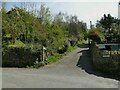
3
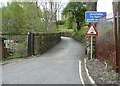
Road signs, Watson Mill Lane
The blue information sign is the usual sort; I haven't seen the red triangle type used for this purpose before.
Image: © Humphrey Bolton
Taken: 16 May 2013
0.05 miles
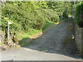
4
Steep hill sign, Watson Mill Lane
The sign indicates 20% (1 in 5).
Image: © Stephen Craven
Taken: 24 Apr 2021
0.06 miles
5

Aflex Hose, Watson Mill Lane
The factory is built partly on the alignment of the former Sowerby Bridge to Rishworth railway line and partly on the former tenterfield of Watson Mill. Jeffrey Fisher, in his history of the railway published in 1990, describes the factory as "recently erected". The old tunnel portal can just be glimpsed behind the factory, see Image
Image: © Stephen Craven
Taken: 24 Apr 2021
0.06 miles
6

Sign for Rosehill Polymers, Watson Mill Lane
This image was taken to show the ram's head, which presumably came from a demolished building in Spring Bank Mills.
Image: © Humphrey Bolton
Taken: 16 May 2013
0.07 miles
7
Footpath from Scar Head
The path heads directly up the hill.
Image: © Stephen Craven
Taken: 24 Apr 2021
0.08 miles
8
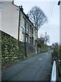
Sowerby Bridge FP78 at Long Lane, Sowerby Bridge
The bottom end of the path is on a driveway, There is a signpost. The old boundary between Sowerby Bridge and Norland goes up the wall on the western side of the footpath.
Image: © Humphrey Bolton
Taken: 22 Aug 2015
0.08 miles
9
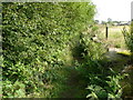
Overhanging trees on Sowerby Bridge FP78
Image: © Humphrey Bolton
Taken: 22 Aug 2015
0.08 miles
10
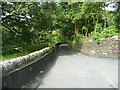
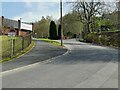
Wall lining on Long Lane, Norland
This seems to be made of a hard cement-based material, not rubber as I first guessed. It is perhaps there to protect the wall from vehicles hitting it, coming too quickly out of Goose Nest lane on the right.
Image: © Humphrey Bolton
Taken: 22 Aug 2015
0.09 miles