IMAGES TAKEN NEAR TO
Rochdale Road, SOWERBY BRIDGE, HX6 3NE

Introduction

This page details the photographs taken nearby to Rochdale Road, HX6 3NE by members of the Geograph project.

The Geograph project started in 2005 with the aim of publishing, organising and preserving representative images for every square kilometre of Great Britain, Ireland and the Isle of Man.

There are currently over 7.5m images from over14,400 individuals and you can help contribute to the project by visiting https://www.geograph.org.uk

Image Map


Images are licensed for reuse under creativecommons.org/licenses/by-sa/2.0
Notes
  • Clicking on the map will re-center to the selected point.
  • The higher the marker number, the further away the image location is from the centre of the postcode.

Image Listing (130 Images Found)

Images are licensed for reuse under creativecommons.org/licenses/by-sa/2.0
  • ...
Image
Details
Distance
1
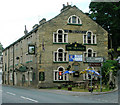
The Triangle
Public house on Rochdale Road, Triangle.
Image: © David Dixon Taken: 3 Sep 2010
0.01 miles
2
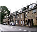
Houses - Rochdale Road, Triangle
Image: © Betty Longbottom Taken: 1 Oct 2008
0.01 miles
3
Stansfield Mills
A conversion of part of Stansfield Mills, Triangle, into apartments.
Image: © John Illingworth Taken: 3 Sep 2008
0.04 miles
4
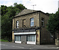
Triangle - former store on Rochdale Road
Opposite the junction with Stansfield Mill Lane.
Image: © Dave Bevis Taken: 4 Sep 2013
0.04 miles
5
Stansfield Mill Lane - Rochdale Rd
Image: © Betty Longbottom Taken: 6 Jan 2015
0.05 miles
6
Stansfield Mill Lane at Rochdale Road, Triangle, Sowerby
Image: © Humphrey Bolton Taken: 6 Sep 2015
0.05 miles
7
Ordnance Survey Flush Bracket 848
This can be found on the wall of a building in Rochdale Road at Triangle. For more detail see : http://www.bench-marks.org.uk/bm9853
Image: © Peter Wood Taken: 13 Jun 2014
0.05 miles
8
Pub/War Memorial
The Triangle Inn at Triangle, between Sowerby Bridge and Ripponden. The plaque below the Fosters banner is a memorial to the '... Fallen of Triangle district in the Great War 1914.1919'
Image: © Ian M Taken: 6 Aug 2005
0.06 miles
9
Inn
Triangle Inn, Triangle. According to leeds-camra.com 'Changes to the turnpike system led to the formation of a triangle of roads between Halifax and Rochdale and when the pub was built in 1760 it became known as the Triangle. As the hamlet developed it took the name of the pub - quite the opposite of what usually happens.' That the pub was the centre point of the area is shown by the incorporation into the N. wall of the memorial to the fallen locals in the First World War. As recently as 1919 Triangle would have been 'out in the sticks', and in 2005 enjoys a semi-rural (sub-suburban) location.
Image: © Ian M Taken: 6 Aug 2005
0.06 miles
10
War Memorial, Triangle, Sowerby
A war memorial on the wall of a pub must be quite unusual. The small plaque states that “The original roll of honour is displayed inside the Triangle. Please feel free to view.”
Image: © Humphrey Bolton Taken: 20 Sep 2007
0.06 miles
  • ...