IMAGES TAKEN NEAR TO
SOWERBY BRIDGE, HX6 3LG
Introduction
This page details the photographs taken nearby to HX6 3LG by members of the Geograph project.
The Geograph project started in 2005 with the aim of publishing, organising and preserving representative images for every square kilometre of Great Britain, Ireland and the Isle of Man.

There are currently over 7.5m images from over14,400 individuals and you can help contribute to the project by visiting https://www.geograph.org.uk
Image Map
Images are licensed for reuse under creativecommons.org/licenses/by-sa/2.0
Notes
- Clicking on the map will re-center to the selected point.
- The higher the marker number, the further away the image location is from the centre of the postcode.
Image Listing (71 Images Found)
Images are licensed for reuse under creativecommons.org/licenses/by-sa/2.0
Image
Details
Distance
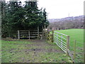
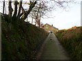
1
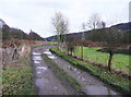
The Binn Royd track passing Calder Dale
This is Sowerby bridge FP145
Image: © Humphrey Bolton
Taken: 26 Jan 2015
0.03 miles
2
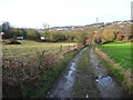
The Binn Royd track towards Calder Dale
Image: © Humphrey Bolton
Taken: 2 Feb 2015
0.09 miles
3
Sowerby Bridge FP83 at the Binn Royd track
This path leads to North Dean Road at Tinker Hey.
Image: © Humphrey Bolton
Taken: 26 Jan 2015
0.10 miles
4
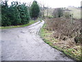
The Binn Royd track at a footpath junction
Here the path number changes from Sowerby Bridge FP145 to FP149, and FP83 goes to the left, to Tinker Hey.
Image: © Humphrey Bolton
Taken: 26 Jan 2015
0.10 miles
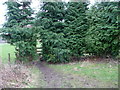
5
Stile on Sowerby Bridge FP83
This is the same path as Elland FP01, in Norland, west of the footbridge over Maple Dean Clough.
Image: © Humphrey Bolton
Taken: 26 Jan 2015
0.11 miles
6
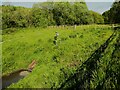
Outlet to the flood storage area, Norland
There is what looks like a solar-powered flow measurement apparatus.
Image: © Humphrey Bolton
Taken: 16 May 2023
0.12 miles
8
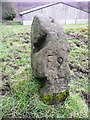
Stone near Elland FP01 and Sowerby bridge FP149
This seems to be an old gatepost with slots for removable bars. It is inscribed 'F9'. It is tempting to think it is a 19C orienteering station!
Image: © Humphrey Bolton
Taken: 26 Jan 2015
0.12 miles
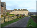
9
The Binn Royd track approaching Lower Binn Royd Farm
This is Sowerby Bridge FP149
Image: © Humphrey Bolton
Taken: 2 Feb 2015
0.12 miles
10
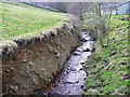
Maple Dean Clough from the footbridge
There is a rather alarming soil cliff, which looks as if it will slump into the water eventually. A ford is shown here on the 1850 six-inch map, which suggests that perhaps the stream bed level was much higher then.
Image: © Humphrey Bolton
Taken: 2 Feb 2015
0.12 miles