IMAGES TAKEN NEAR TO
Lilly Street, SOWERBY BRIDGE, HX6 3GE
Introduction
This page details the photographs taken nearby to Lilly Street, HX6 3GE by members of the Geograph project.
The Geograph project started in 2005 with the aim of publishing, organising and preserving representative images for every square kilometre of Great Britain, Ireland and the Isle of Man.

There are currently over 7.5m images from over14,400 individuals and you can help contribute to the project by visiting https://www.geograph.org.uk
Image Map
Images are licensed for reuse under creativecommons.org/licenses/by-sa/2.0
Notes
- Clicking on the map will re-center to the selected point.
- The higher the marker number, the further away the image location is from the centre of the postcode.
Image Listing (331 Images Found)
Images are licensed for reuse under creativecommons.org/licenses/by-sa/2.0
Image
Details
Distance
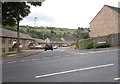
1
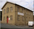
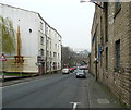
Community Centre, Foundry Street, Sowerby Bridge
This was a Wesleyan Mission chapel, according to the inscription over the door.
Image: © Humphrey Bolton
Taken: 20 Sep 2007
0.02 miles
2
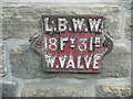
Sowerby Bridge Local Board Water Works valve marker plate
This one is only a few metres away from Image, on the same wall, and is probably the one shown in Image
Image: © Humphrey Bolton
Taken: 19 May 2014
0.02 miles
6
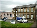
Elim Chapel, Ryburn Street, Sowerby Bridge
Image: © Humphrey Bolton
Taken: 9 Mar 2012
0.05 miles
8
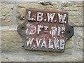
Sowerby Bridge Local Board Water Works valve marker plate
Sowerby Bridge Local Board was one of the first to be established in this area. The first election was on 30 July 1856. One of the first tasks was to commission a report on the water supply, and this resulted in the construction of a reservoir at Cote Hill and water mains to serve, initially, 400 houses. The water works was opened on 17 August 1864.
Image: © Humphrey Bolton
Taken: 31 Mar 2014
0.06 miles
9
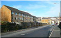
Location of LBWW valve marker plate, West Street
See Image
Image: © Humphrey Bolton
Taken: 31 Mar 2014
0.06 miles
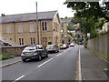
10
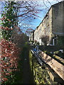
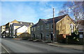
Path to Hulme Street from West Street
Image: © Humphrey Bolton
Taken: 10 Feb 2014
0.06 miles