IMAGES TAKEN NEAR TO
Burnley Road, SOWERBY BRIDGE, HX6 2TZ
Introduction
This page details the photographs taken nearby to Burnley Road, HX6 2TZ by members of the Geograph project.
The Geograph project started in 2005 with the aim of publishing, organising and preserving representative images for every square kilometre of Great Britain, Ireland and the Isle of Man.

There are currently over 7.5m images from over14,400 individuals and you can help contribute to the project by visiting https://www.geograph.org.uk
Image Map
Images are licensed for reuse under creativecommons.org/licenses/by-sa/2.0
Notes
- Clicking on the map will re-center to the selected point.
- The higher the marker number, the further away the image location is from the centre of the postcode.
Image Listing (116 Images Found)
Images are licensed for reuse under creativecommons.org/licenses/by-sa/2.0
Image
Details
Distance
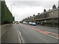
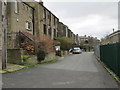
1
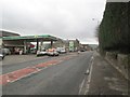
Burnley Road - viewed from Bright Street
Image: © Betty Longbottom
Taken: 26 Jan 2015
0.02 miles
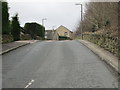
3
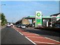
BP Filling Station, Burnley Road, Friendly
Passing the BP garage and Spar shop.
Image: © David Dixon
Taken: 3 Sep 2010
0.03 miles
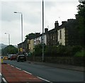
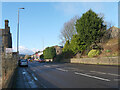
5
Burnley Road - viewed from Bright Street
Image: © Betty Longbottom
Taken: 26 Jan 2015
0.04 miles
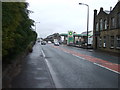
8
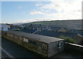
Garages on Langton Street seen from a petrol station on Burnley Road (A646), Sowerby Bridge
Image: © habiloid
Taken: 3 Jan 2025
0.04 miles
10
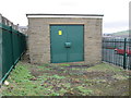
Electricity Substation No 1468 - Bright Street
Image: © Betty Longbottom
Taken: 26 Jan 2015
0.05 miles