IMAGES TAKEN NEAR TO
SOWERBY BRIDGE, HX6 2JL
Introduction
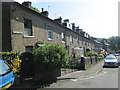
This page details the photographs taken nearby to HX6 2JL by members of the Geograph project.
The Geograph project started in 2005 with the aim of publishing, organising and preserving representative images for every square kilometre of Great Britain, Ireland and the Isle of Man.

There are currently over 7.5m images from over14,400 individuals and you can help contribute to the project by visiting https://www.geograph.org.uk
Image Map
Images are licensed for reuse under creativecommons.org/licenses/by-sa/2.0
Notes
- Clicking on the map will re-center to the selected point.
- The higher the marker number, the further away the image location is from the centre of the postcode.
Image Listing (79 Images Found)
Images are licensed for reuse under creativecommons.org/licenses/by-sa/2.0
Image
Details
Distance


6
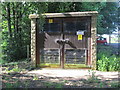
Electricity Substation No 930 - Steps Lane
Image: © Betty Longbottom
Taken: 31 May 2014
0.08 miles
7
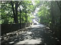
Dam Head Road - viewed from Steps Lane
Image: © Betty Longbottom
Taken: 31 May 2014
0.09 miles

10
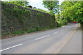
Looking north along Wood Nook Lane
There is an OS benchmark Image on the wall on the left hand side of the wall, on a stone left of a piece of wood propped against the wall.
Image: © Roger Templeman
Taken: 16 May 2018
0.11 miles