IMAGES TAKEN NEAR TO
Hill Crest Avenue, SOWERBY BRIDGE, HX6 2HA
Introduction
This page details the photographs taken nearby to Hill Crest Avenue, HX6 2HA by members of the Geograph project.
The Geograph project started in 2005 with the aim of publishing, organising and preserving representative images for every square kilometre of Great Britain, Ireland and the Isle of Man.

There are currently over 7.5m images from over14,400 individuals and you can help contribute to the project by visiting https://www.geograph.org.uk
Image Map
Images are licensed for reuse under creativecommons.org/licenses/by-sa/2.0
Notes
- Clicking on the map will re-center to the selected point.
- The higher the marker number, the further away the image location is from the centre of the postcode.
Image Listing (130 Images Found)
Images are licensed for reuse under creativecommons.org/licenses/by-sa/2.0
Image
Details
Distance
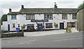
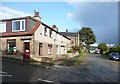
2
The Friendly Snooker Club, Burnley Road, Sowerby Bridge
This was built in 1920 for the Friendly Band. They had to move to smaller premises in 1933, and the Snooker Club acquired it, and probably extended it. Strictly it is in Warley, as the Sowerby Bridge boundary ran along Burnley Road.
Image: © Humphrey Bolton
Taken: 2 Oct 2008
0.03 miles
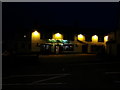
3
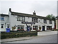
The Waiters Arms, Tuel Lane, Sowerby Bridge
Image: © Alexander P Kapp
Taken: 25 Sep 2008
0.03 miles
5
Byron Street, Sowerby Bridge
A suburban barber's shop, with the candy-striped pole in the window.
Image: © Humphrey Bolton
Taken: 2 Oct 2008
0.04 miles
7

Bright Street - looking towards Tuel Lane
Image: © Betty Longbottom
Taken: 26 Jan 2015
0.05 miles
8
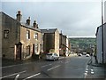
Tuel Lane A6139, Sowerby Bridge
The steep link between the A 58 at the bottom and the A646 Burnley Road at the top.
Image: © Humphrey Bolton
Taken: 2 Oct 2008
0.06 miles
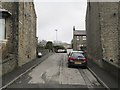
9
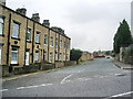
Junction
The junction of Bright Street and Tuel Lane
Image: © Alexander P Kapp
Taken: 25 Sep 2008
0.06 miles
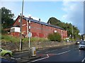
10
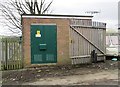
Electricity Substation No 168 - Bright Street
Image: © Betty Longbottom
Taken: 26 Jan 2015
0.06 miles