
IMAGES TAKEN NEAR TO
Nichols Yard, SOWERBY BRIDGE, HX6 2EE
Introduction
This page details the photographs taken nearby to Nichols Yard, HX6 2EE by members of the Geograph project.
The Geograph project started in 2005 with the aim of publishing, organising and preserving representative images for every square kilometre of Great Britain, Ireland and the Isle of Man.

There are currently over 7.5m images from over14,400 individuals and you can help contribute to the project by visiting https://www.geograph.org.uk
Image Map
Images are licensed for reuse under creativecommons.org/licenses/by-sa/2.0
Notes
- Clicking on the map will re-center to the selected point.
- The higher the marker number, the further away the image location is from the centre of the postcode.
Image Listing (466 Images Found)
Images are licensed for reuse under creativecommons.org/licenses/by-sa/2.0
Image
Details
Distance
1
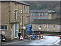
Sowerby Bridge - bottom of Tower Hill
Looking down to the A58 road.
Image: © Dave Bevis
Taken: 19 Feb 2014
0.02 miles
2
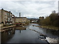
River Calder from County Bridge
Looking downstream
Image: © Alexander P Kapp
Taken: 7 Apr 2010
0.02 miles
3
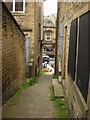
Ginnel between Corporation Street and Town Hall Street
Image: © Alexander P Kapp
Taken: 4 Jun 2009
0.03 miles
4
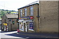
Dino's Convenience Store, #3 Tower Hill at Corporation Street junction
Image: © Luke Shaw
Taken: 29 Jun 2018
0.03 miles
5

Sowerby Bridge - south side of Town Hall Street
Image: © Dave Bevis
Taken: 19 Feb 2014
0.03 miles
6
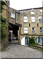
Former boiler-house of Carlton Mill, Sowerby Bridge
This was connected to the chimney on the left by flues through the building over the old packhorse route. Now converted to apartments.
Image: © Humphrey Bolton
Taken: 2 Jul 2006
0.03 miles
7
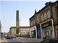
The western end of Wharf Street, Sowerby Bridge
The street sign on the right marks the change to Town Hall Street. The chimney was for the Carlton Mill behind it. On the right is a 19C building with shops flanking a central doorway that led through to Sowerby Bridge Mills behind.
Image: © Humphrey Bolton
Taken: 2 Jul 2006
0.03 miles
8
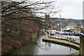
Rochdale Canal, Sowerby Bridge
Looking eastwards from Tower Hill bridge. The new winding hole is in the foreground, further away is Tuel Deep Lock. Christ Church is seen and, on the skyline, the Wainhouse Tower.
Image: © Dr Neil Clifton
Taken: 23 Feb 2008
0.03 miles
9
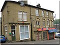
Building in Tower Hill
Initials A.S. and Date 1878
Image: © Alan Longbottom
Taken: 30 May 2008
0.03 miles
10
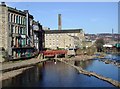
The River Calder, Sowerby Bridge
Weir on the River Calder where it is joined by the River Ryburn at Sowerby Bridge, looking north-northeast from the southern end of County Bridge on Town Hall Street.
Image: © Paul Glazzard
Taken: 4 Apr 2007
0.03 miles