IMAGES TAKEN NEAR TO
Alexandra Close, SOWERBY BRIDGE, HX6 2DP
Introduction
This page details the photographs taken nearby to Alexandra Close, HX6 2DP by members of the Geograph project.
The Geograph project started in 2005 with the aim of publishing, organising and preserving representative images for every square kilometre of Great Britain, Ireland and the Isle of Man.

There are currently over 7.5m images from over14,400 individuals and you can help contribute to the project by visiting https://www.geograph.org.uk
Image Map
Images are licensed for reuse under creativecommons.org/licenses/by-sa/2.0
Notes
- Clicking on the map will re-center to the selected point.
- The higher the marker number, the further away the image location is from the centre of the postcode.
Image Listing (338 Images Found)
Images are licensed for reuse under creativecommons.org/licenses/by-sa/2.0
Image
Details
Distance
2
Lower Clifton Street, Sowerby Bridge
It is not surprising that this street has been closed to traffic. The gradient is at least 1 in 4, and it goes straight down to the busy main road.
Image: © Humphrey Bolton
Taken: 5 Mar 2009
0.05 miles
3
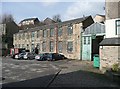
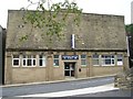
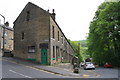
Clough Works, Sowerby Bridge
Built across the floor of the clough (narrow valley). The stream is culverted under the building.
Image: © Humphrey Bolton
Taken: 5 Mar 2009
0.05 miles
6
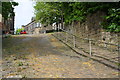
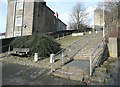
A steep cobbled road, Lower Clifton Street
There is an OS benchmark Image at the angle of the wall at the right hand side of the road
Image: © Roger Templeman
Taken: 16 May 2018
0.06 miles
7
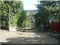
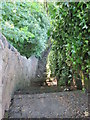
Lower Clifton Street, Sowerby Bridge
This street drops extremely steeply to the main road, and has consequently been closed to traffic.
Image: © Humphrey Bolton
Taken: 2 Aug 2018
0.06 miles
8
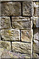
Benchmark on stones at junction of walls, Lower Clifton Street
Ordnance Survey cut mark benchmark levelled at 101.654m above Newlyn Datum
Image: © Roger Templeman
Taken: 16 May 2018
0.06 miles
9
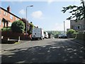
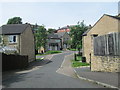
Sunnybank Street - viewed from Church View
Image: © Betty Longbottom
Taken: 31 May 2014
0.06 miles
10
Violet Terrace houses viewed across Park Road
There is an OS benchmark Image on the nearest house on a stone in its wall right of the gate
Image: © Roger Templeman
Taken: 16 May 2018
0.06 miles