IMAGES TAKEN NEAR TO
Pollit Avenue, SOWERBY BRIDGE, HX6 1LE
Introduction
This page details the photographs taken nearby to Pollit Avenue, HX6 1LE by members of the Geograph project.
The Geograph project started in 2005 with the aim of publishing, organising and preserving representative images for every square kilometre of Great Britain, Ireland and the Isle of Man.

There are currently over 7.5m images from over14,400 individuals and you can help contribute to the project by visiting https://www.geograph.org.uk
Image Map
Images are licensed for reuse under creativecommons.org/licenses/by-sa/2.0
Notes
- Clicking on the map will re-center to the selected point.
- The higher the marker number, the further away the image location is from the centre of the postcode.
Image Listing (169 Images Found)
Images are licensed for reuse under creativecommons.org/licenses/by-sa/2.0
Image
Details
Distance
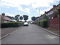
4
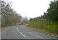
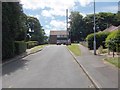
Sowerby New Road, Sowerby
The new road with its steady gradient has here been cut into the hillside on the right, and the north-facing retaining wall is covered in green algae.
Image: © Humphrey Bolton
Taken: 27 Feb 2009
0.04 miles
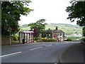
7
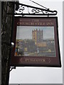
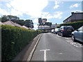
The Church Stile Inn, Sowerby, Sign
Image: © Alexander P Kapp
Taken: 28 Apr 2009
0.08 miles
8
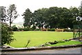
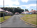
Sowerby Tennis & Bowls Club - St Peter's Avenue
Image: © Betty Longbottom
Taken: 1 Oct 2008
0.08 miles
10
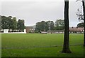
Sowerby St Peter's Cricket Club - St Peter's Avenue
Image: © Betty Longbottom
Taken: 1 Oct 2008
0.09 miles