IMAGES TAKEN NEAR TO
The Newlands, SOWERBY BRIDGE, HX6 1HQ
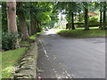
Introduction
This page details the photographs taken nearby to The Newlands, HX6 1HQ by members of the Geograph project.
The Geograph project started in 2005 with the aim of publishing, organising and preserving representative images for every square kilometre of Great Britain, Ireland and the Isle of Man.

There are currently over 7.5m images from over14,400 individuals and you can help contribute to the project by visiting https://www.geograph.org.uk
Image Map
Images are licensed for reuse under creativecommons.org/licenses/by-sa/2.0
Notes
- Clicking on the map will re-center to the selected point.
- The higher the marker number, the further away the image location is from the centre of the postcode.
Image Listing (174 Images Found)
Images are licensed for reuse under creativecommons.org/licenses/by-sa/2.0
Image
Details
Distance
1
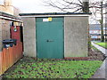
Electricity Substation No 1721 - The Newlands
Image: © Betty Longbottom
Taken: 6 Jan 2015
0.04 miles
2
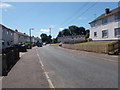
Sowerby Bridge FP100 at a housing estate, Sowerby
Here the path shown in Image] joins a tarmac path to Rooley Banks.
Image: © Humphrey Bolton
Taken: 6 Sep 2015
0.07 miles
3
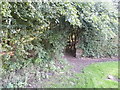
Sowerby Bridge FP100 at Rooley Banks, Sowerby
Image: © Humphrey Bolton
Taken: 6 Sep 2015
0.07 miles
4
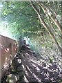
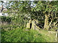
Sowerby bridge FP100, Sowerby
This is the path between the stile shown in Image] and a housing estate (Rooley Banks).
Image: © Humphrey Bolton
Taken: 6 Sep 2015
0.08 miles
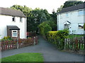
9
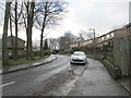
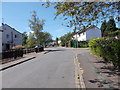
Dean Lane in Sowerby at its junction with The Newlands
Looking southward.
Image: © Peter Wood
Taken: 9 Aug 2017
0.11 miles
10
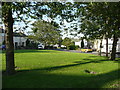
Rooley Banks - viewed from Broadway
Image: © Betty Longbottom
Taken: 30 Jun 2015
0.11 miles