IMAGES TAKEN NEAR TO
Bates Avenue, SOWERBY BRIDGE, HX6 1DH
Introduction
This page details the photographs taken nearby to Bates Avenue, HX6 1DH by members of the Geograph project.
The Geograph project started in 2005 with the aim of publishing, organising and preserving representative images for every square kilometre of Great Britain, Ireland and the Isle of Man.

There are currently over 7.5m images from over14,400 individuals and you can help contribute to the project by visiting https://www.geograph.org.uk
Image Map
Images are licensed for reuse under creativecommons.org/licenses/by-sa/2.0
Notes
- Clicking on the map will re-center to the selected point.
- The higher the marker number, the further away the image location is from the centre of the postcode.
Image Listing (100 Images Found)
Images are licensed for reuse under creativecommons.org/licenses/by-sa/2.0
Image
Details
Distance
1
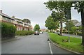
Bates Avenue - St Peter's Avenue, Sowerby
Image: © Betty Longbottom
Taken: 1 Oct 2008
0.01 miles
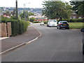
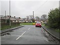
3

Bates Avenue - viewed from Kingsley Avenue
Image: © Betty Longbottom
Taken: 30 Jun 2015
0.02 miles
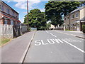
4
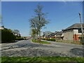
Bates Avenue, Beechwood, Sowerby
From the post-War era when land was cheap enough for roads on housing estates to be built as dual carriageways.
Image: © Stephen Craven
Taken: 24 Apr 2021
0.03 miles
5
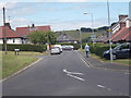
Bates Avenue - viewed from Kingsley Avenue
Image: © Betty Longbottom
Taken: 30 Jun 2015
0.04 miles
6
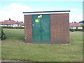
Electricity Substation No 1739 - Kingsley Avenue
Image: © Betty Longbottom
Taken: 30 Jun 2015
0.04 miles
7
Beechwood Crescent - St Peter's Avenue
Image: © Betty Longbottom
Taken: 6 Jan 2015
0.06 miles
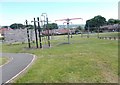
9
Beechwood Avenue - Whiteley Avenue
Image: © Betty Longbottom
Taken: 30 Jun 2015
0.06 miles
10
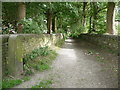
Brock Well Lane, Sowerby
This is part of Sowerby Bridge FP97. It goes down to Brock Well and then turns left to Haugh End Lane.
Image: © Humphrey Bolton
Taken: 29 Aug 2015
0.08 miles